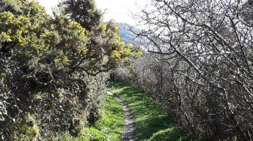
Pendeen to Treen
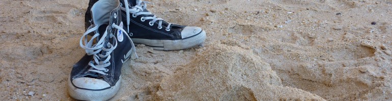
39,000 steps
“…Newquay to Land’s End: a coastal hike of such constant yet varied beauty that no right-minded person would ever want it to end.”
– Gary Hayden, describing the end of his walk from John O’Groats to Land’s End
Next morning, there is no more water falling from the sky. But there’s plenty on the ground. When I take my clean socks from their plastic bag, they’re wet. The newspaper that I put in my boots to dry them appears to be wetter than the boots were last night. As do the boots.
When we set out, the air is cold and damp, and everything is wet. Streams of water are still running down the street that we take out of Pendeen. But it’s not raining.
There’s a bit of faffing about as we try to find the Path. It ought to be simple – head for the coast – but we end up retracing our steps several times, and wandering all over the dreary post-industrial wasteland around Geevor Tin Mine.

Geevor Tin Mine
 Most of the time, it’s easy to overlook how heavily industrialised Cornwall once was, now that it is mostly tourist resorts and unspoilt coastline. But you can’t overlook it here. The Geevor mine closed as recently as 1990. It’s now a Unesco World Heritage site (which is hard to believe, looking at it).
During the 20th century Geevor had over 85 miles of tunnels, and produced 50,000 tons of tin. It wasn’t a workplace I would have fancied: over a million gallons of water, a quarter of which was sea-water, was pumped from the mine daily.
Once we have located the Path, we head south, expecting to reach Land’s End by lunchtime. For various reasons, progress is slower than I expect.
 The first problem is that the Path is, well, a little ‘vague’ in places. It’s easy to be misled into following the wrong trail. At one point, we miss a turn we should take and find ourselves walking along an increasingly narrow cliff path, clambering over rocks as the way becomes gradually less of a path and more of an invitation to fall into the sea. Eventually, we come to our senses, and climb over a steep ridge to re-find the correct route.
 The second cause of delay is the Path’s irritating habit of buggering us about, and winding in and out instead of pursuing a sensibly direct route. I know it’s a coast path, but you can take these things too far. At one point, I look to the south, thinking that Sennen and Land’s End still seem a long way off. The Path then takes us half a mile inland, and half a mile out again, so that after thirty minutes’ walking we’re at a point a hundred yards south of where we were. This can get irritating.
I’m not complaining, because the absence of rain is a great improvement on yesterday afternoon. But there is still a lot of water and mud around, which makes walking hard work, as we scramble from side to side of the Path to find drier ground and surer footing. It slows us down.
The morning is windy and cool. The sea is battleship grey, under a sky the colour of pale ash. We walk through a series of headlands and shallow inlet valleys, working our way south. At Kenidjack Castle, there are evocative remains of an ancient hillfort (one of several on the promontories of this coast). Further on, we cross Cape Cornwall. Until the Ordnance Survey, 200 years ago, people thought the Cape was the most westerly point of Britain. I can’t help wishing the Ordnance Survey hadn’t interfered – the Cape would make a much better Land’s End than the real thing.

Cape Cornwall: Land’s End 1.0
After a strenuous climb over boulders at Nanjulian, Sennen Cove appears below, behind a haze of spray produced by the sizeable waves. We plod on, as the final reason for our slow progress becomes more evident – the Professor is unwell. He falls behind, walking ever more slowly. When at last we stop for lunch in Sennen, the Prof confirms how unwell he is by turning down the offer of a beer. He bales out and gets a taxi to Treen, where we’re staying tonight, leaving me to tackle Land’s End alone.

Having walked all this way to get here, Land’s End itself is a non-event: a sprawl of ugly gift shops and restaurants. I don’t linger long.
In his very funny book about walking the Path with a disreputable dog, ‘Five Hundred Mile Walkies’, Mark Wallington gets into a conversation with a waitress in the canteen at Land’s End.
“…when I told her, as cooly as possible, that I was walking the whole South West coastal path, she said ‘Kevin, the breakfast chef did that last year.’
‘Oh, really.’
‘Yeah. He walked thirty miles a day.’
‘Really.’
‘Yeah. And he’s diabetic or something.
‘Is he!’
‘Yeah. He raised about five thousand quid for a kidney machine.’
‘Did he!’
‘Yeah. He said it was easy enough from Minehead to here, but then it started to get really tough.'”
 Walking away from Land’s End, I feel I’ve reached an important milestone. Until now, since leaving Minehead nearly two years ago, I’ve been walking broadly south of west. From now on, I’ll be going predominantly north of east. I know that this is not yet the halfway point of the walk, but there is a genuine sense that I have turned a corner. From now on, I’m heading back towards home.
 I make rapid progress after Land’s End. The Path soon begins to feel different – an easier cliff top walk, with fewer ascents and descents, and firmer ground. The landscape subtly alters too: approaching Porthgwarra the Path becomes more sheltered, with occasional hedgerows, and a scent of wild garlic.
I am soon at Minack, where a precipitous stone staircase takes the Path down to Porthcurno beach. Up another slope, and a very muddy field path brings me to Treen, where I find – tucked up in bed – the poorly Prof.

 The clocks have gone forward in the night for British Summer Time, and the weather instantly responds, giving us bright sunshine from a clear blue sky as we shoulder our packs and retrace our steps through Treen and down to the coast. The Prof is much recovered. The air is thin and cool and fresh.
 I’ve reached the point on the Path that is as far away from London as I can get. And the journey to Cornwall is tiresome. The train takes us to Plymouth, where we are shepherded onto a bus, for the rest of the journey to the tip of Cornwall. It should take five hours, but it takes eight. I’m sure the Famous Five used to get here quicker.


 The rain is now constant – sweeping in cold sheets across the hillside. As we continue our interminable trudge, it becomes clear that none of my garments is truly waterproof. The rain soaks through my allegedly waterproof trousers, and soaks me to my underpants. It seeps inside my cagoule, which until now has pretended to be waterproof, so that a wet, cold patch spreads across my back beneath the pressure of my rucksack.