Tag Archives: travel

The Portland Loop (and did I mention mud?): South West Coast Path – Days 42 and 43

Abbotsbury to Weymouth

34,000 steps

Isle of Portland

28,000 steps

Today’s walk is described by the guide as “easy.” And so it would be if I didn’t stupidly try to do it all before lunch.

When I set off from Abbotsbury, I’m pleased to find that my muddy boots have dried. Ready to gather more mud. The morning is fresh – warmer than yesterday, with much less wind and no sign of rain.

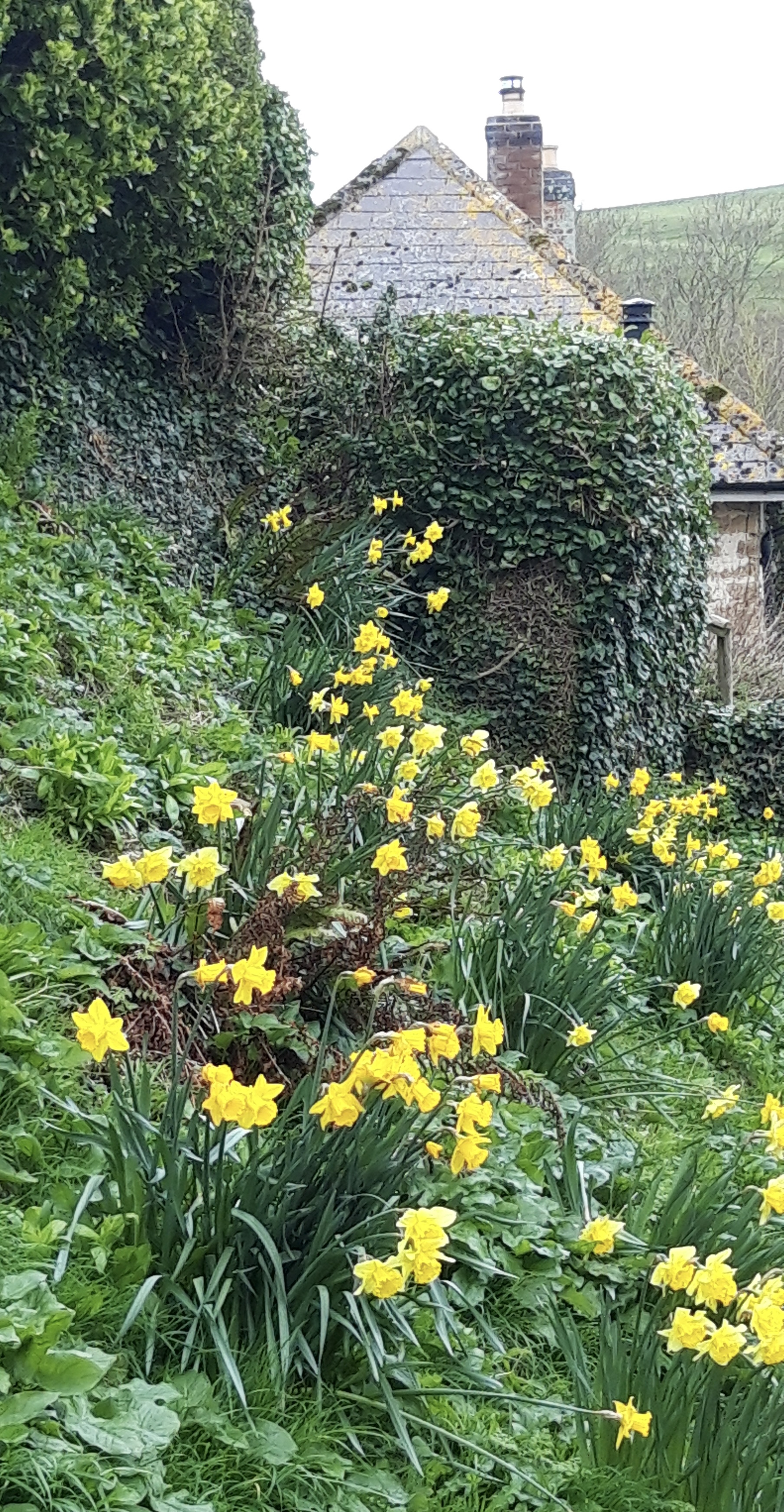
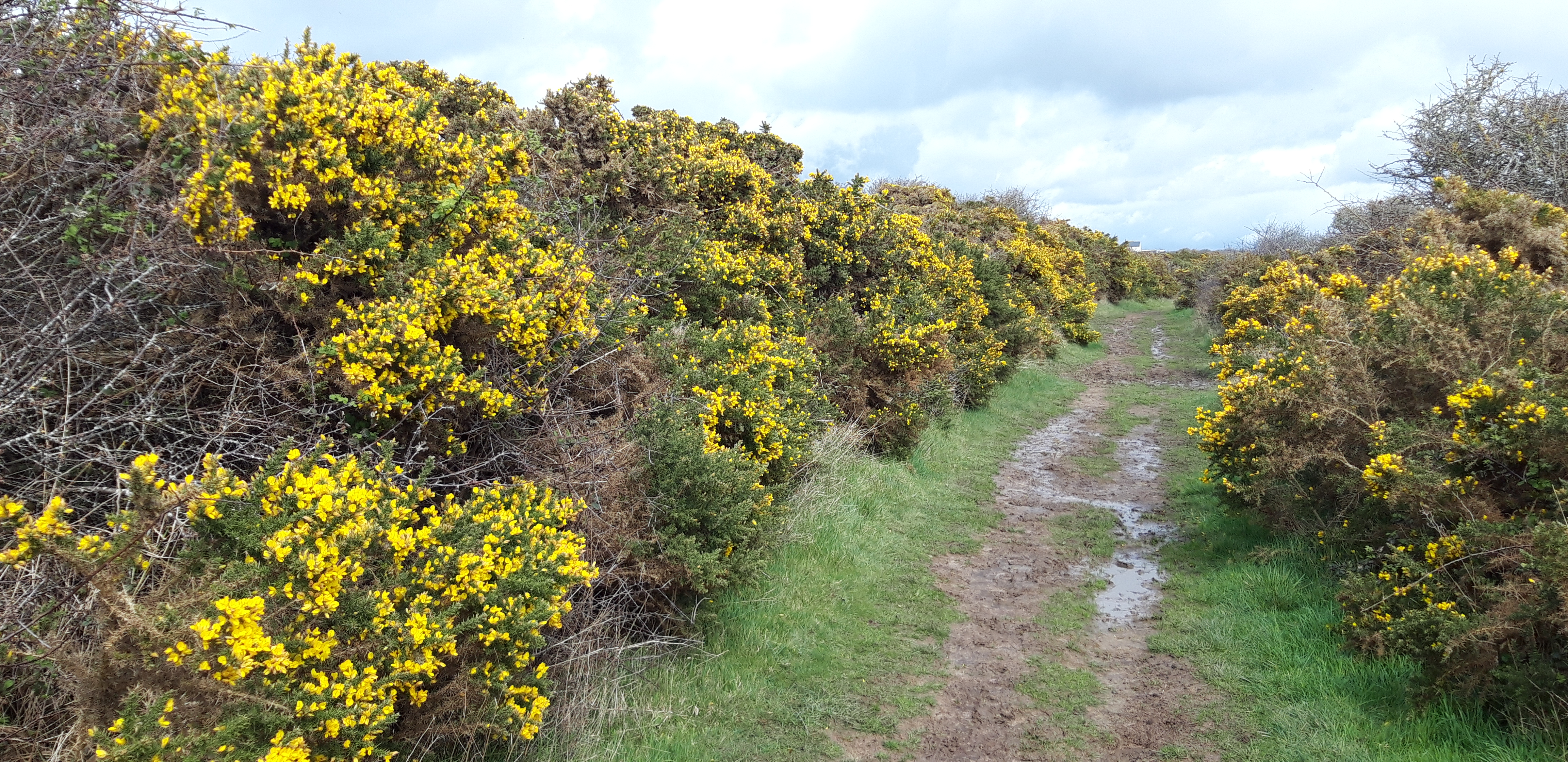
I start with a walk down a pleasant daffodil-fringed lane, accompanied by the relaxing sound of running water in a stream beside the road, and frisky chickens jeering at me from a nearby yard. 

The Swannery has an enticing coffee shop, which I hate to pass up. But it’s way too early. Half a mile on, a sign sends me off the road and up a hill through a field and the real walking begins. I anticipate mud.

I can definitely feel the weight of Chesil Beach in my calves. And my rucksack has got heavier in the night. But overall, I’m upbeat and positive. It feels like the worst of the weather is behind me. Today’s walk is largely inland from the Fleet Lagoon, through rolling fields and easy hills. 

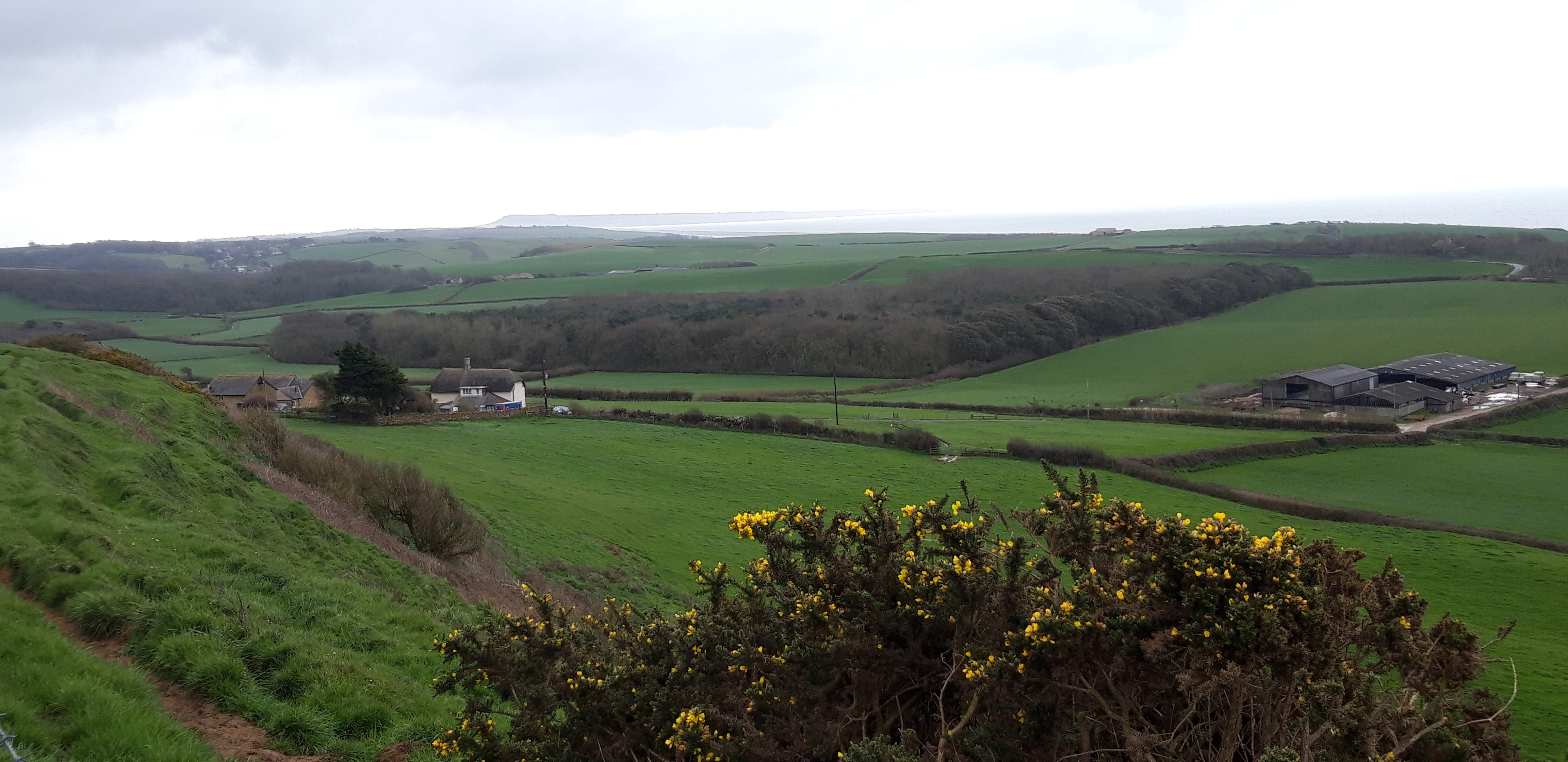
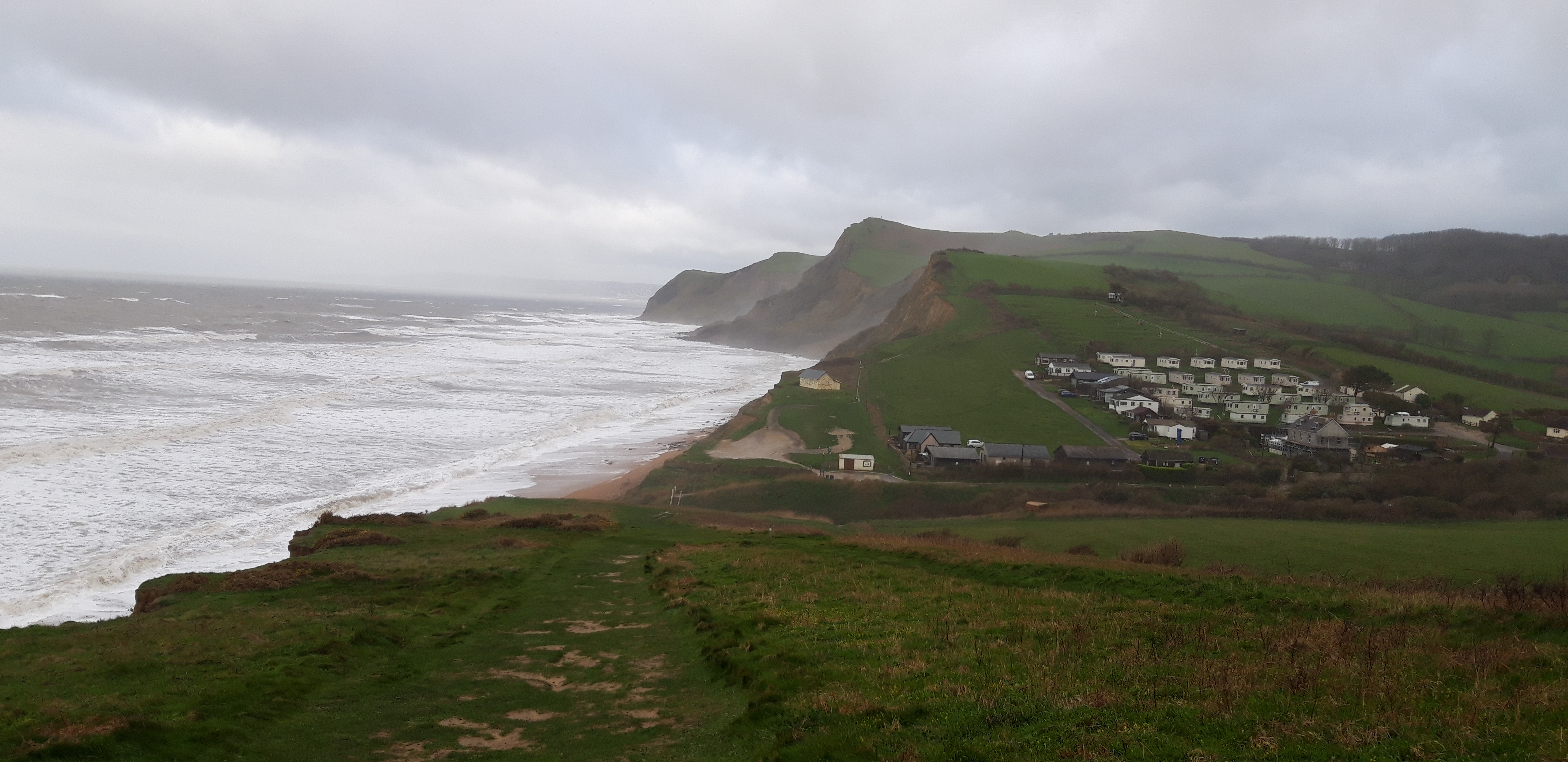
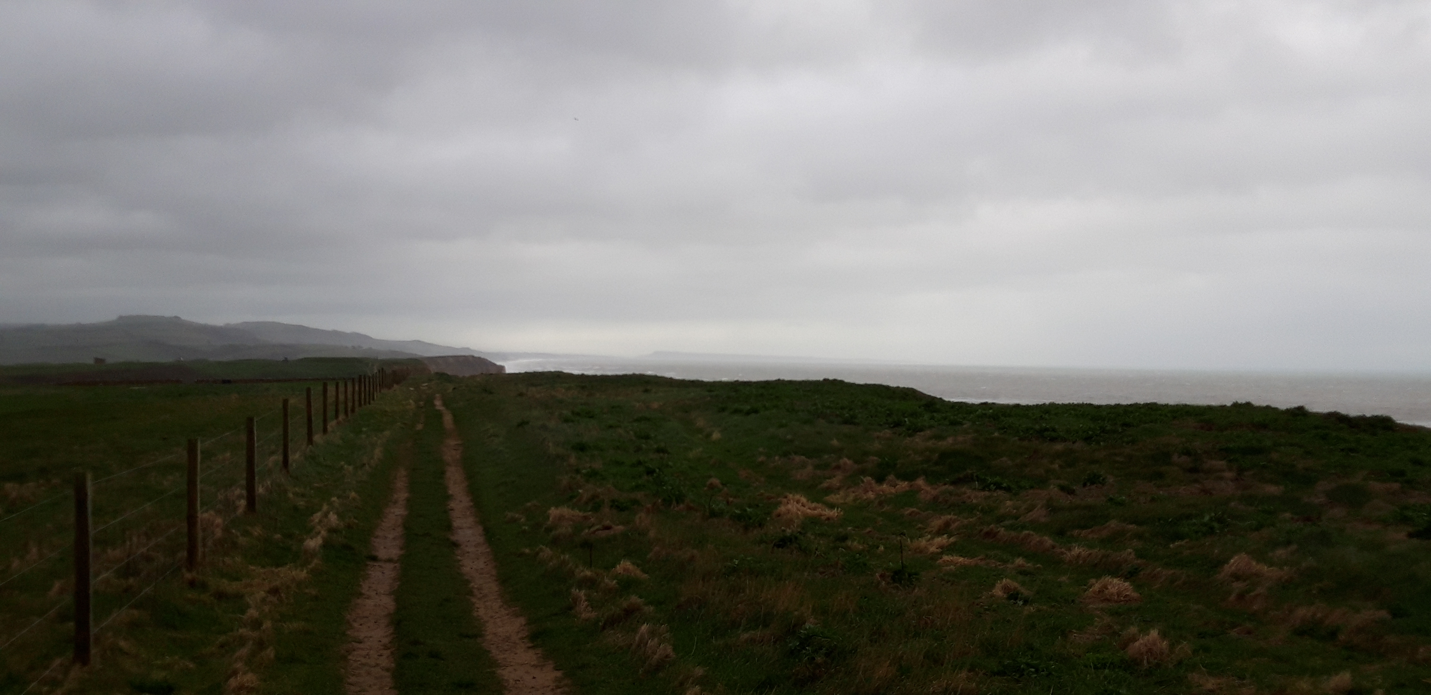
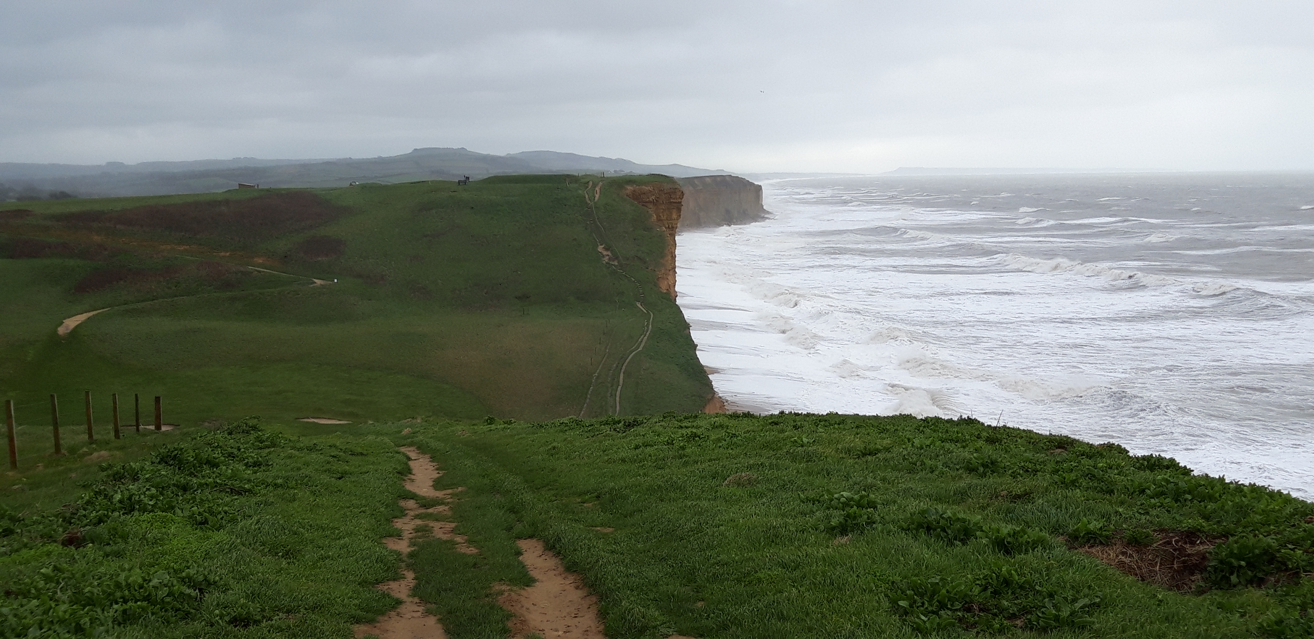
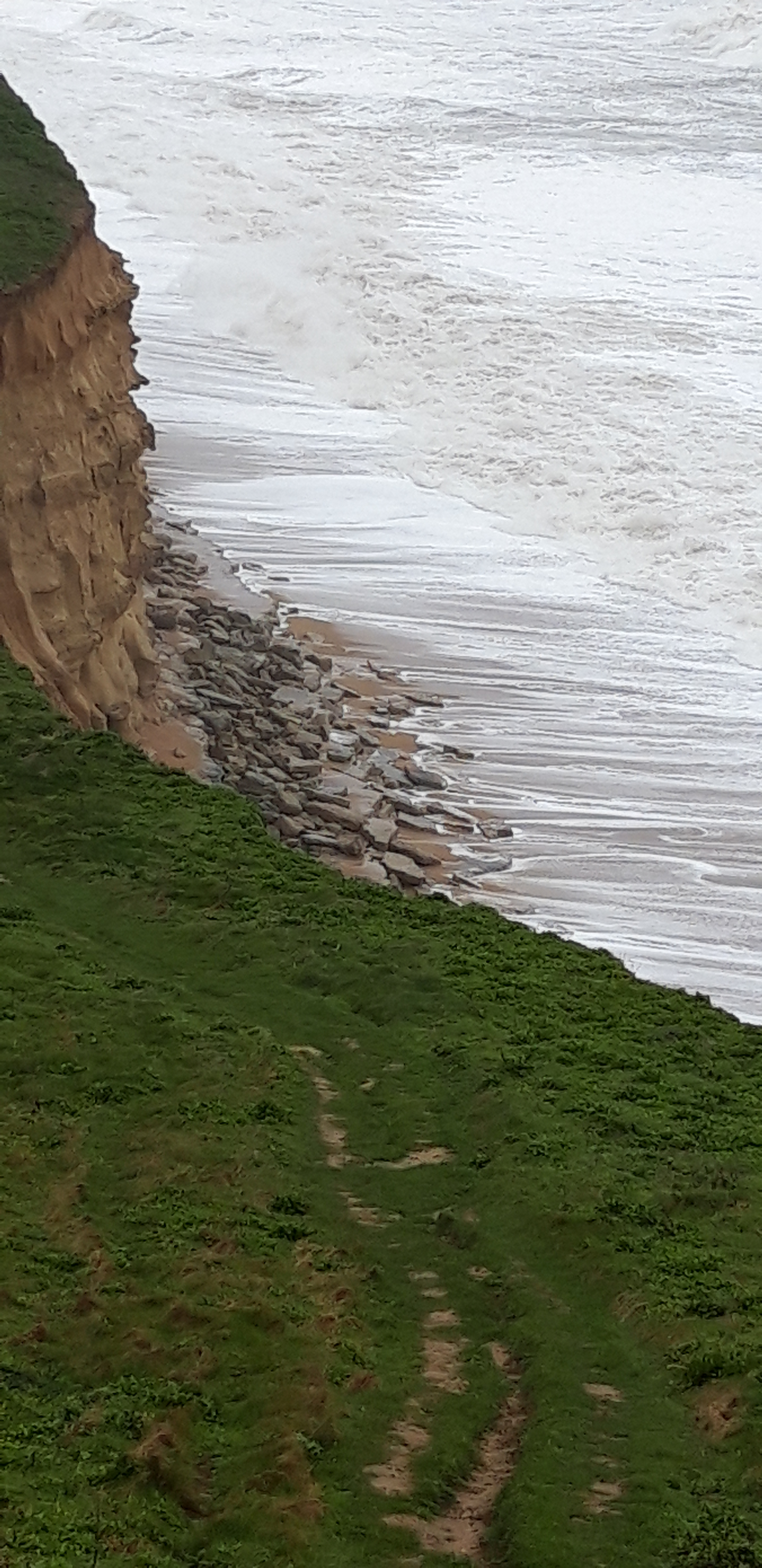
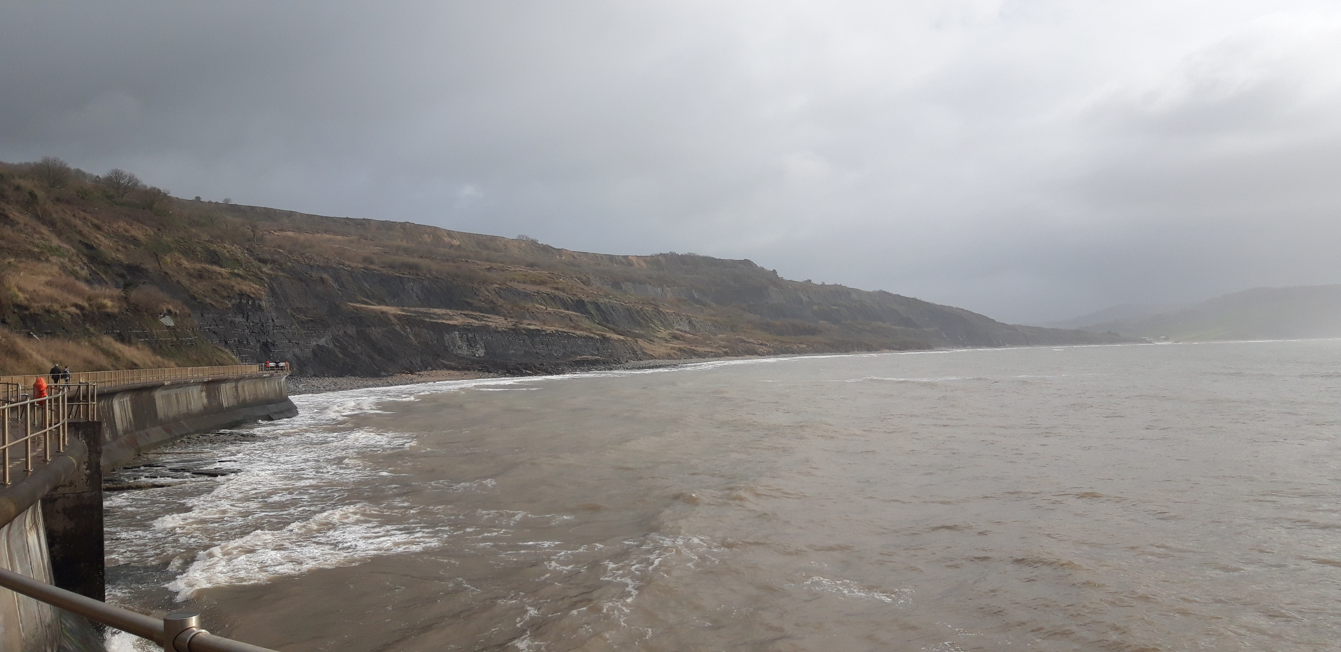
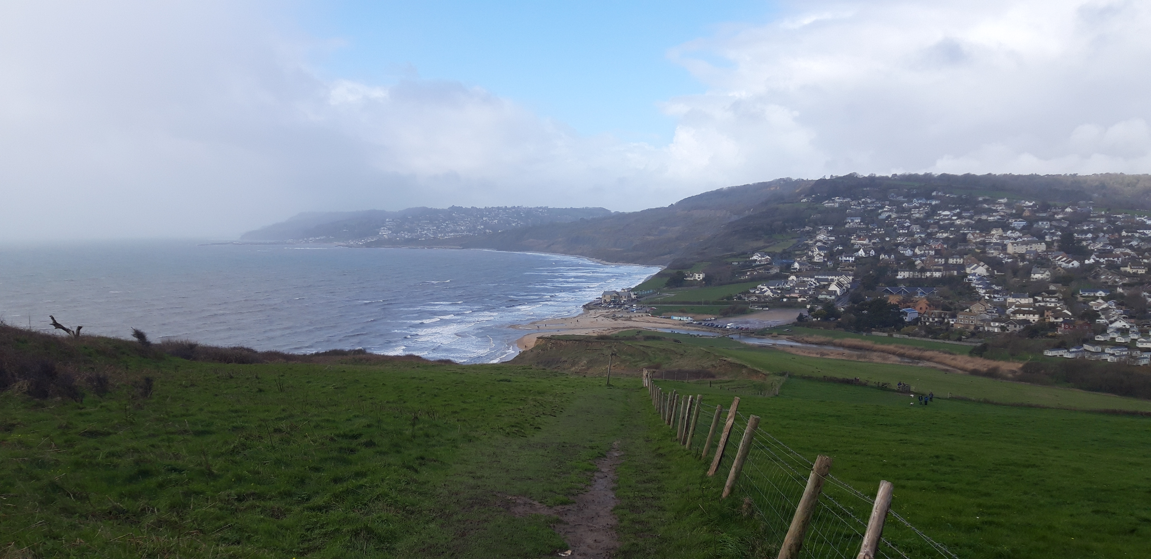
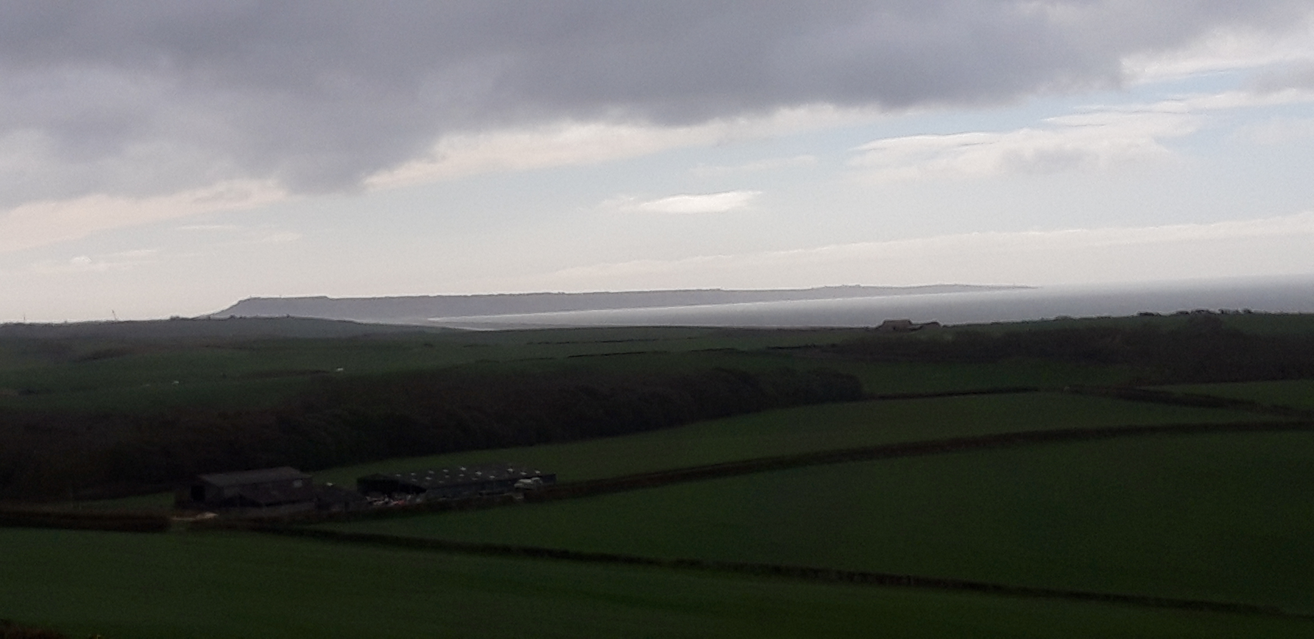
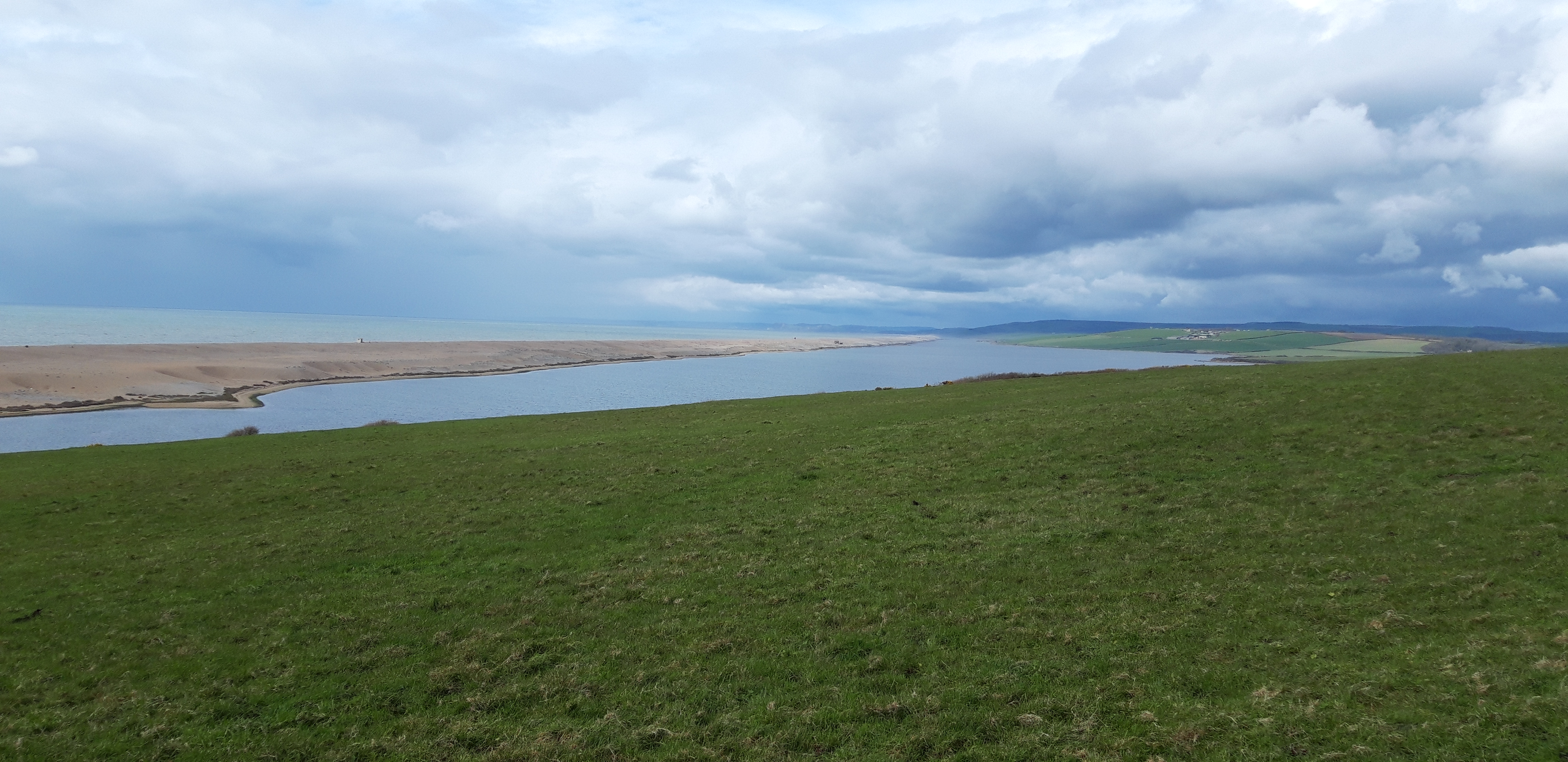
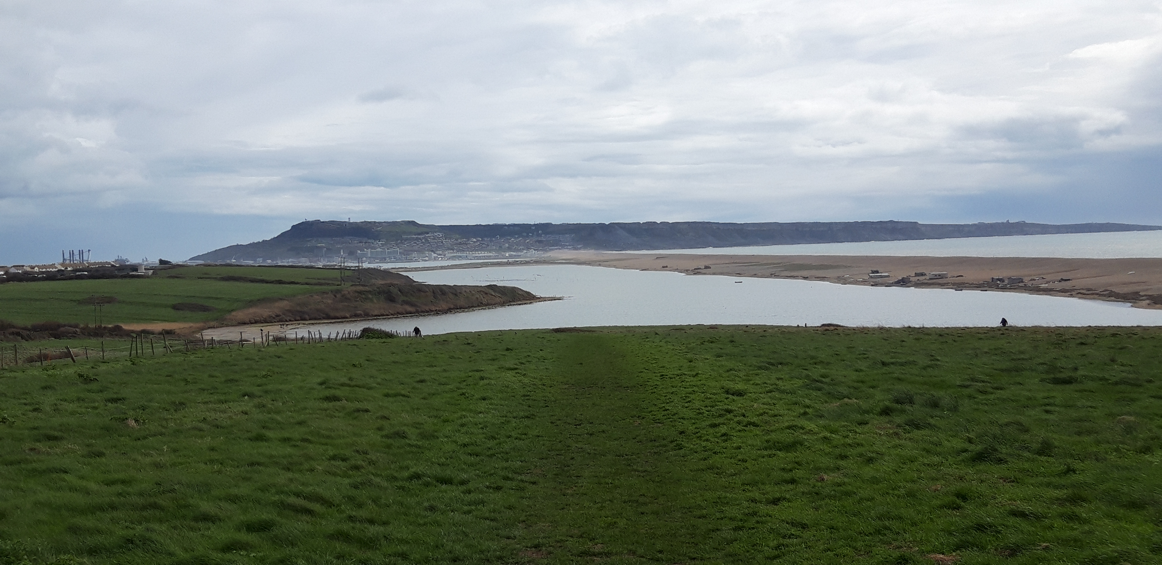
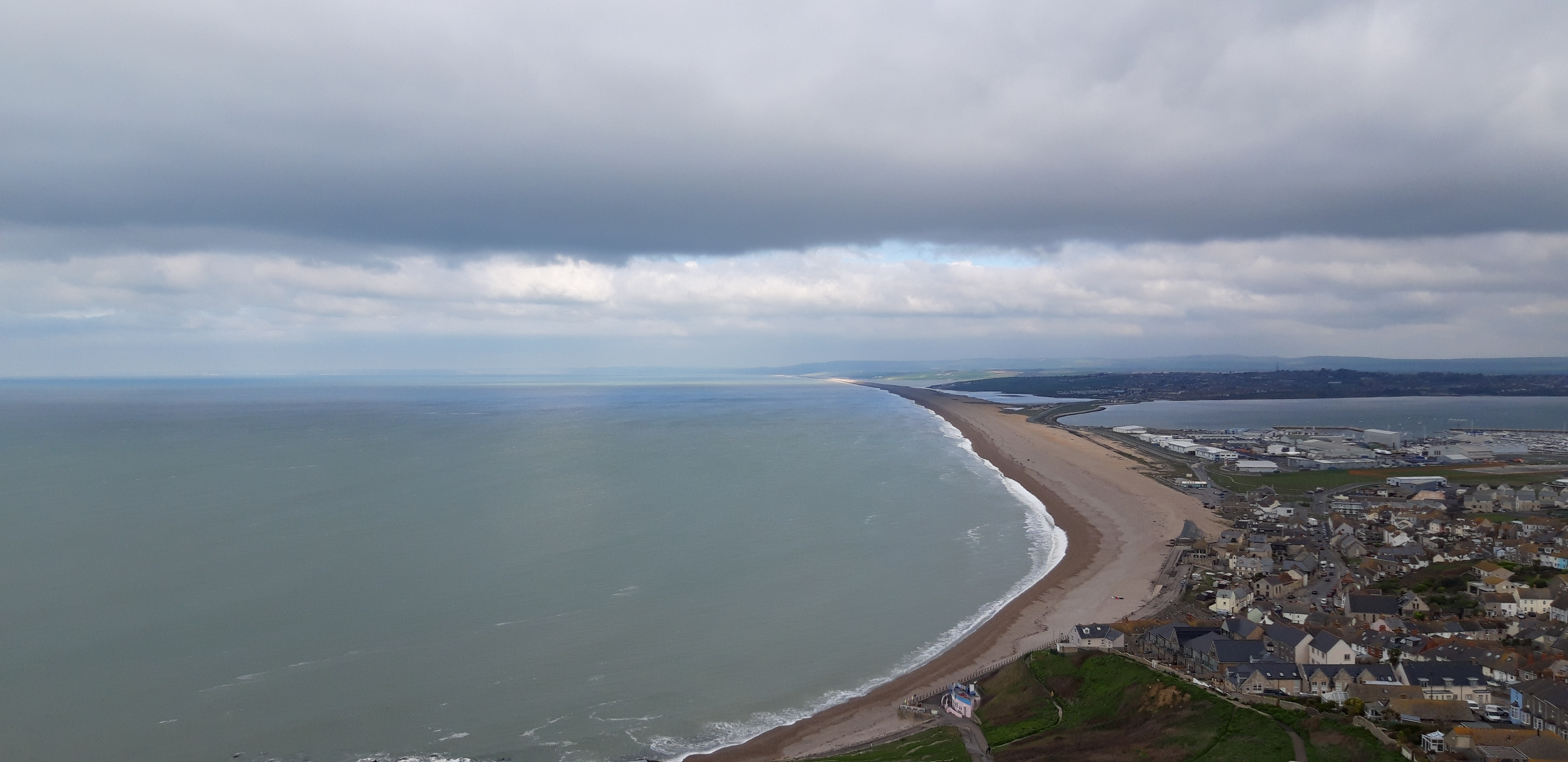
A short walk takes me to the top of Linton Hill, from which I get a sumptuous view of the coast ahead. The Isle of Portland is now clearly visible – a thin wedge, looking like a doorstop propping open the English Channel, or the snout of a half-submerged sea monster dozing at the end of Chesil Beach.

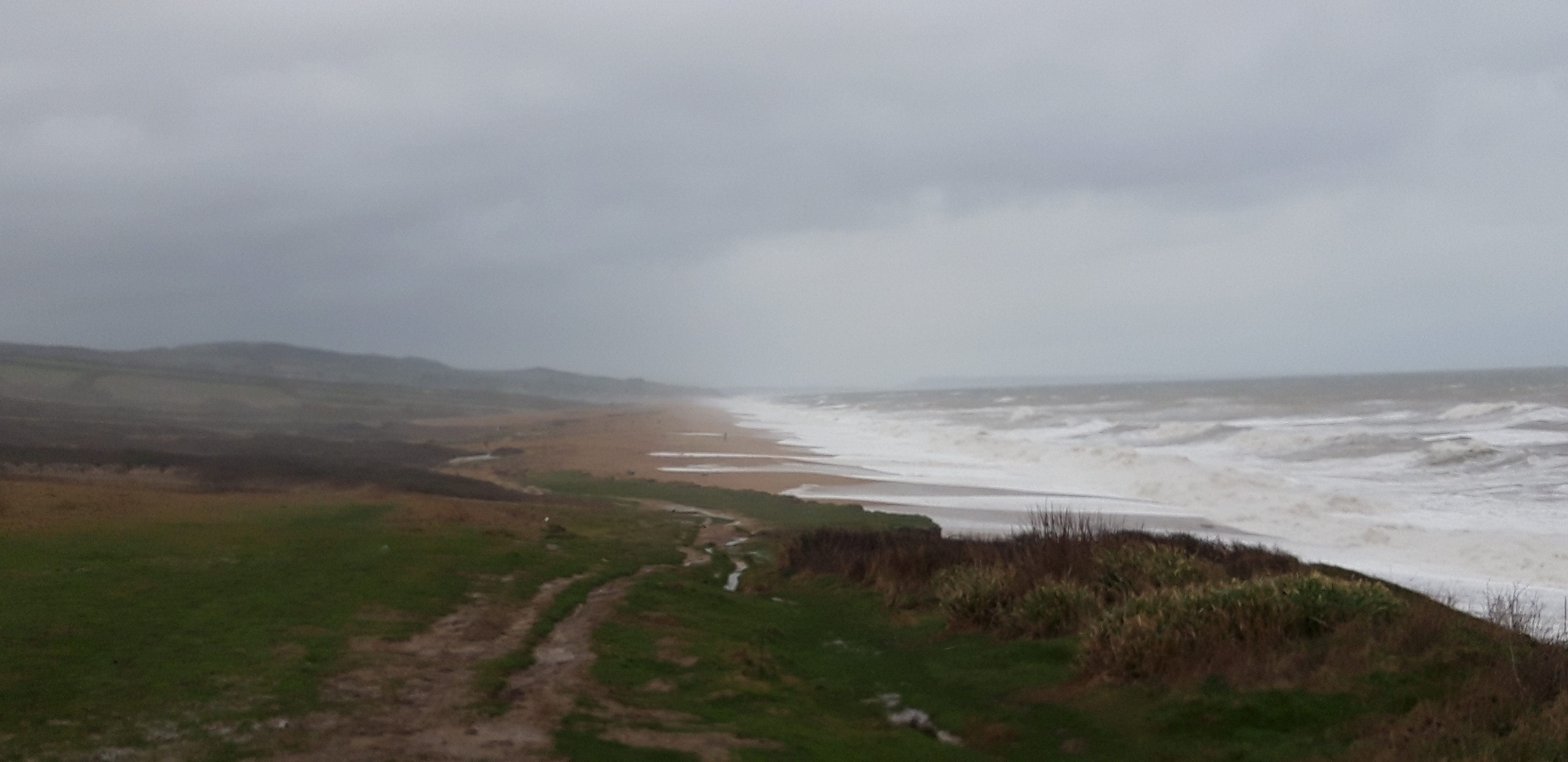
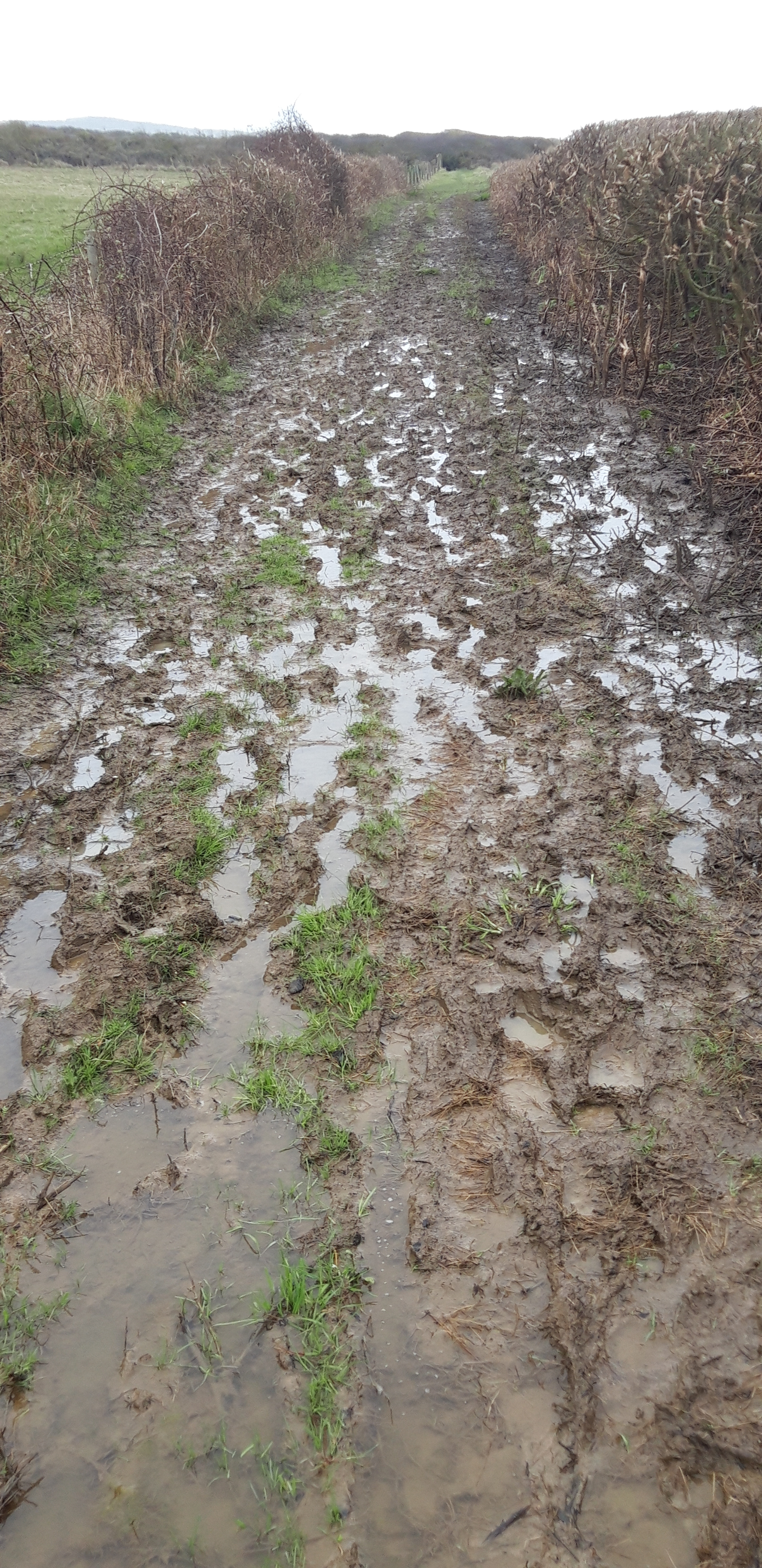
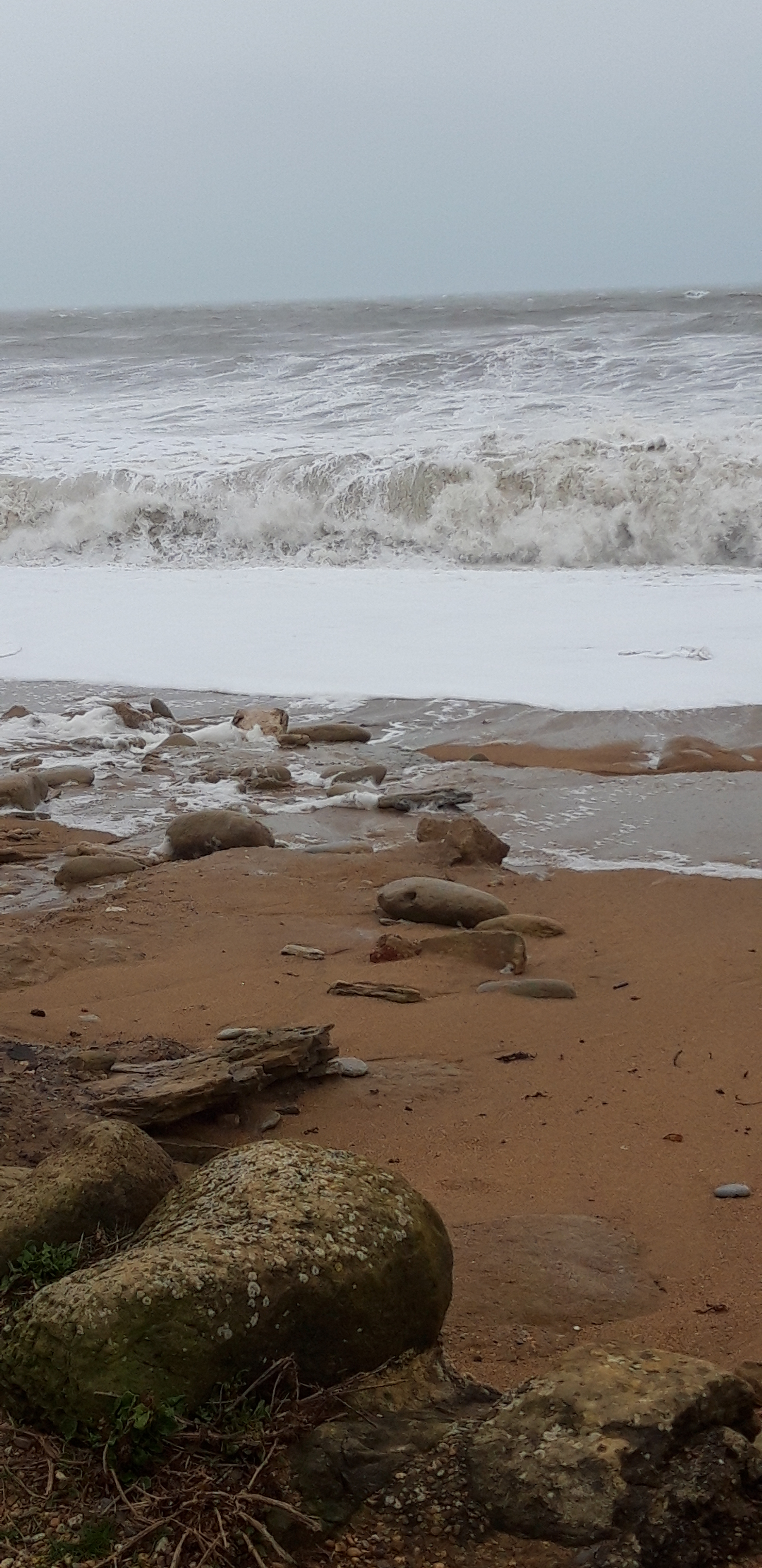
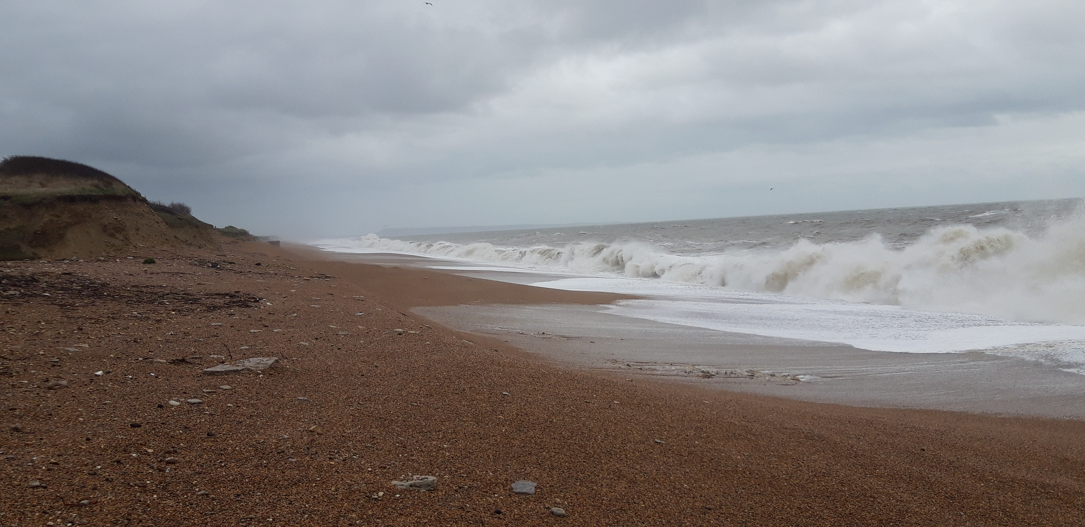
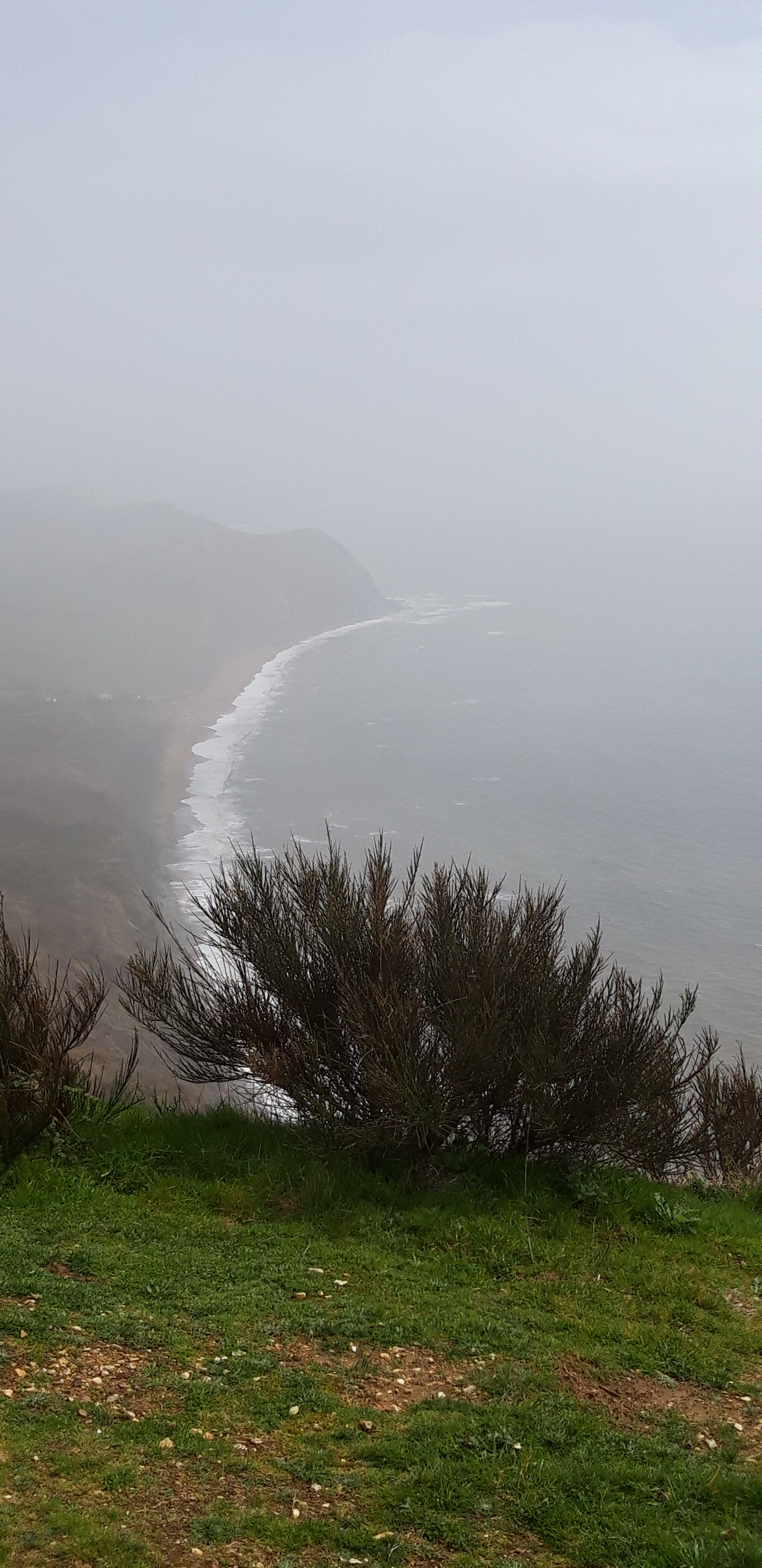
Walking for a while is along a flat, grassy ridge, with great views of the sea and Chesil Beach. But the Path soon dips right and heads toward the coast, and lower ground. Descending from the ridge comes at the price of the mud reasserting itself. At first, it’s short of the Somme-like conditions that I snorkelled through yesterday (but sadly, this doesn’t last).

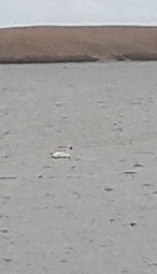
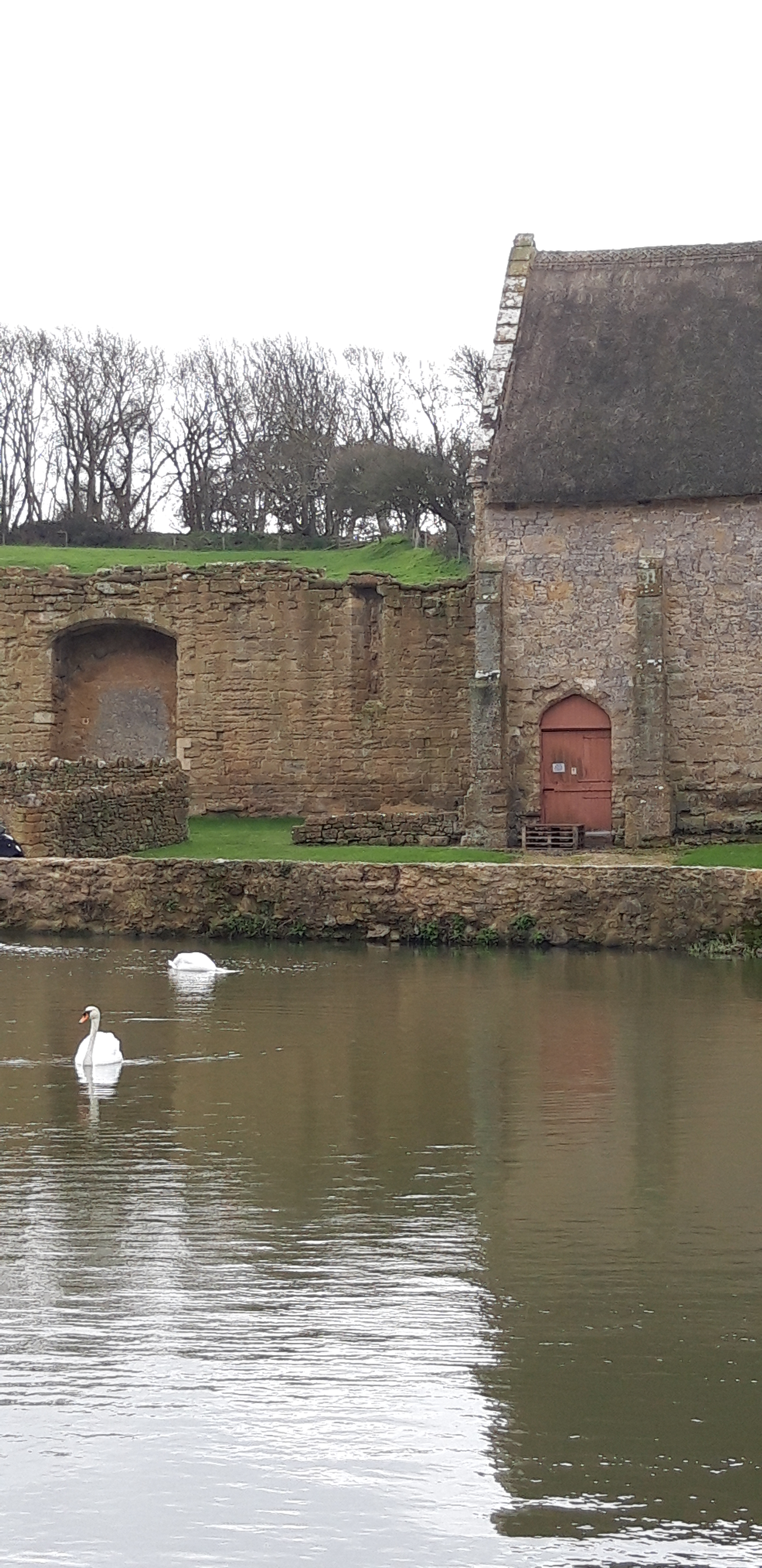
I hike through flat fields, accompanied only by birdsong, before the Path makes its way down to the inland shore of the Fleet lagoon. This part, Rodden Hive, is a nature reserve. Many birds are pictured on a sign. But all I can see is a solitary swan, diving for sea grass.

On this low ground, the mud soon becomes tedious. I pass a walker coming the other way. 

“It doesn’t get any better, I’m afraid,” he says, gesturing back where he’s come from. “It’s horrendous.”

He’s not wrong. Let’s face it, if you wanted to find mud, low-lying fields beside a tidal lagoon after days of heavy rain would be a good place to search.


A sign says ‘Ferrybridge 7’. I walk on and twenty minutes later see another sign claiming that Ferrybridge is now half a mile further away. A little further, I see a sign claiming it’s now five and three quarter miles to Ferrybridge. I guess you just can’t trust signs.

You can’t trust paths either. Just when I think I’ve seen all the mud that it’s possible to fit on one footpath, the Path gets muddier. I come to a military firing range.  No red flags are flying so I continue. The Path becomes titanically muddy. Some patches look like if I fell into the mud I might never come out again. 

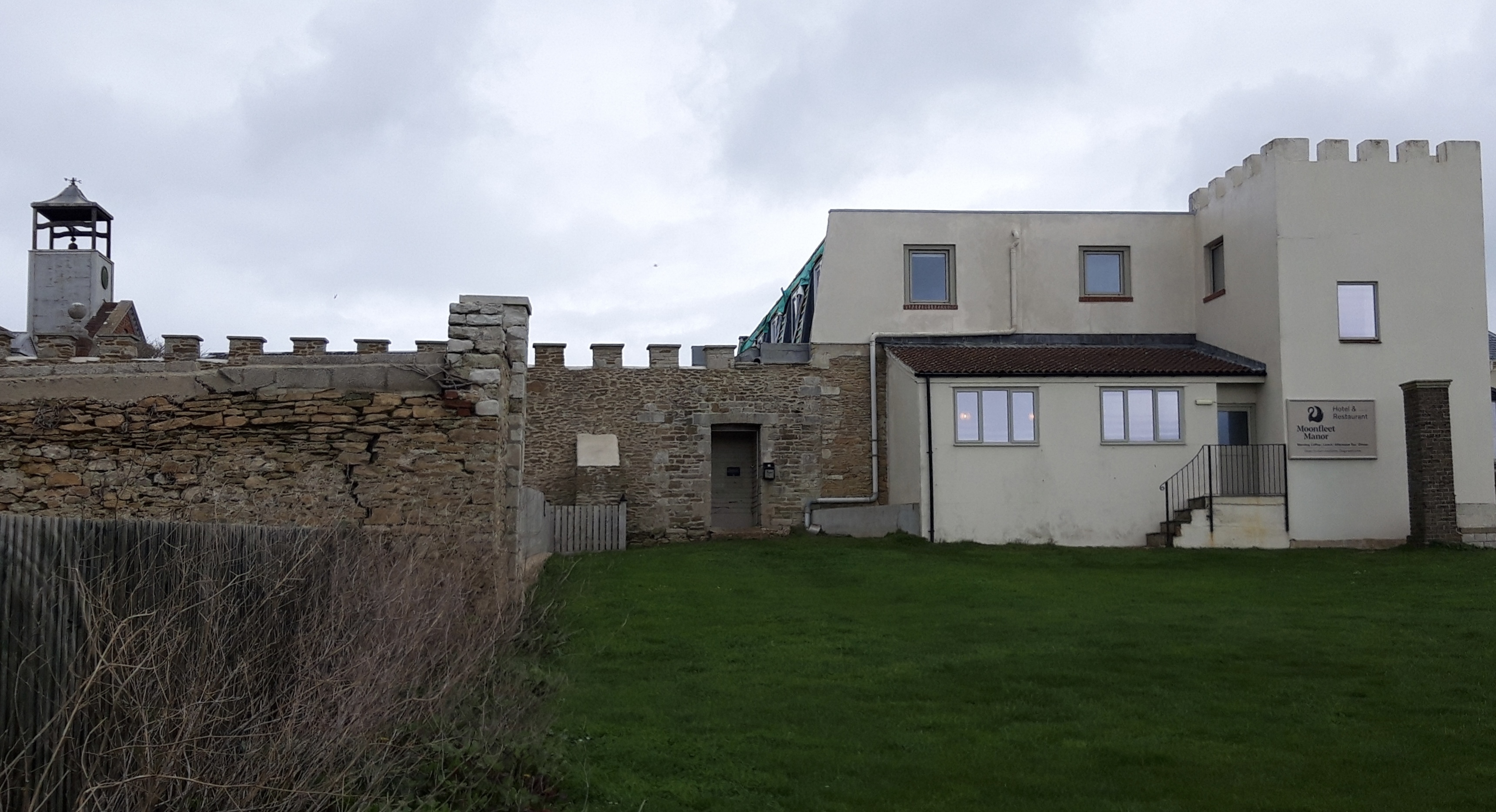
I pass Moonfleet Manor Hotel. A sign says ramblers are welcome. As are pirates. Again, foolishly, I don’t stop but just plod on. Moonfleet – a classic tale of smuggling adventure set on the Fleet – is one of those books I don’t remember ever reading, but I feel I know it intimately. Like Treasure Island.

Moonfleet Manor Hotel

I had planned on turning inland to Chickerel for lunch but it’s still relatively early when I reach the turning. And a sign tells me that Ferrybridge is now only four and a half miles. I decide to plough on, fuelled by a water break and a nut bar.

The mud makes progress slow and I can feel fatigue setting in. My calves still ache from the Chesil exertions.

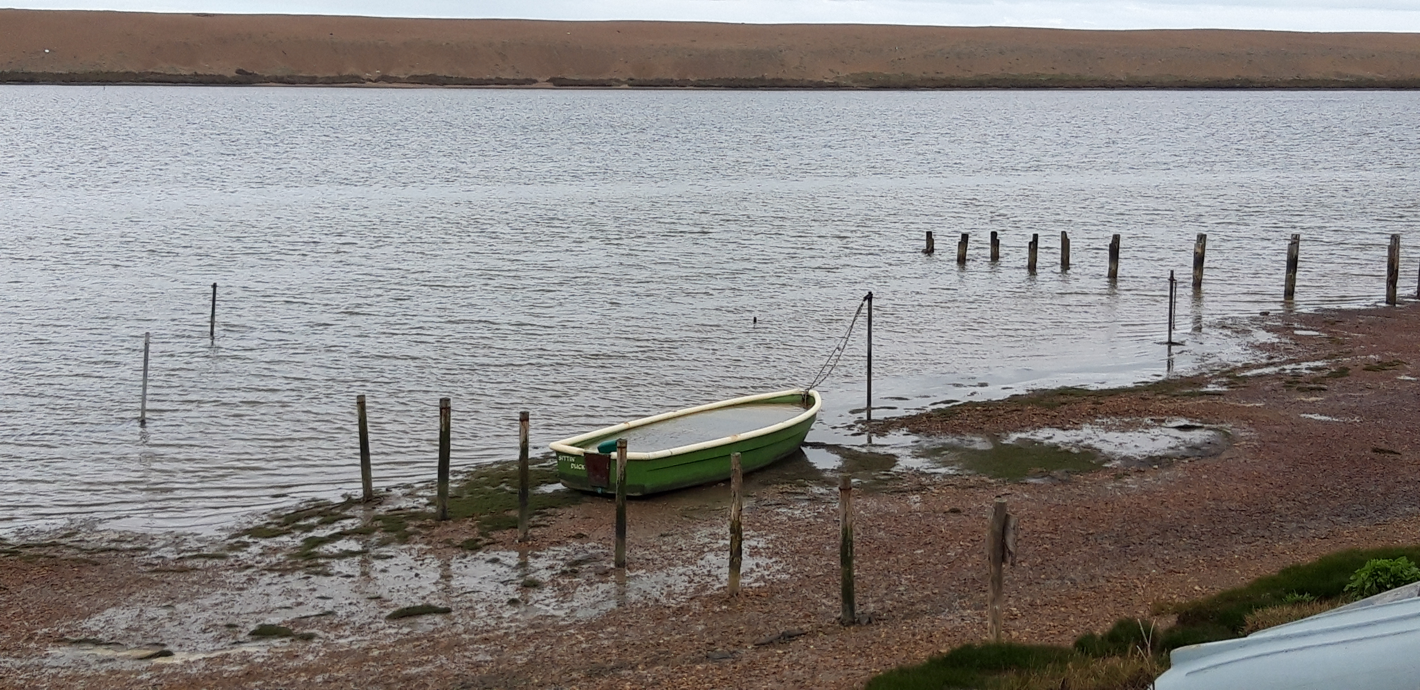
A sign tells me that the Fleet is the largest lagoon in north west Europe. I can believe this because I seem to have been walking along its muddy shoreline for at least a week.

As is the way of the Path, it seems like I will never reach Ferrybridge, but suddenly I’m there. Despite the perils of the mud, I’ve made fast progress. There’s a price to pay: my feet are sore and a blister has appeared on my palm, from the tight grip I’ve had to keep on my stick to keep myself from being swallowed up by mud.

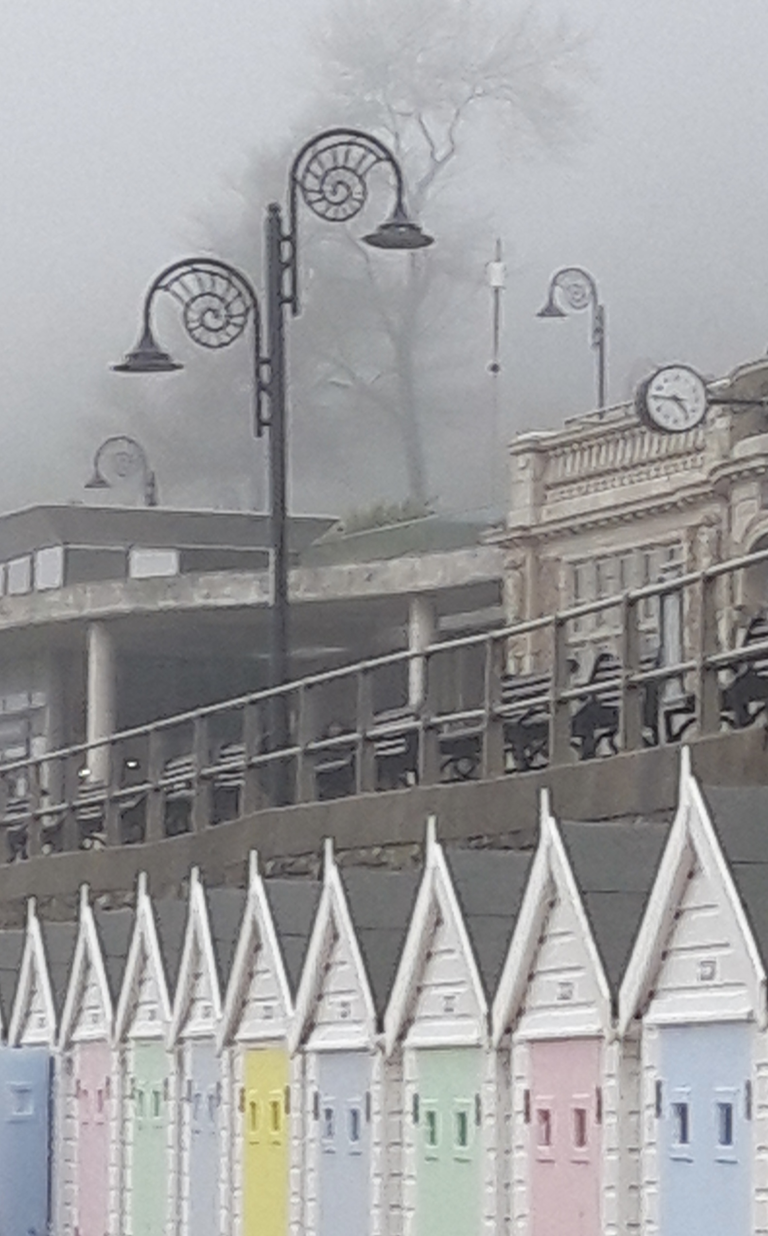
It’s an easy walk around Portland Harbour and into Weymouth.

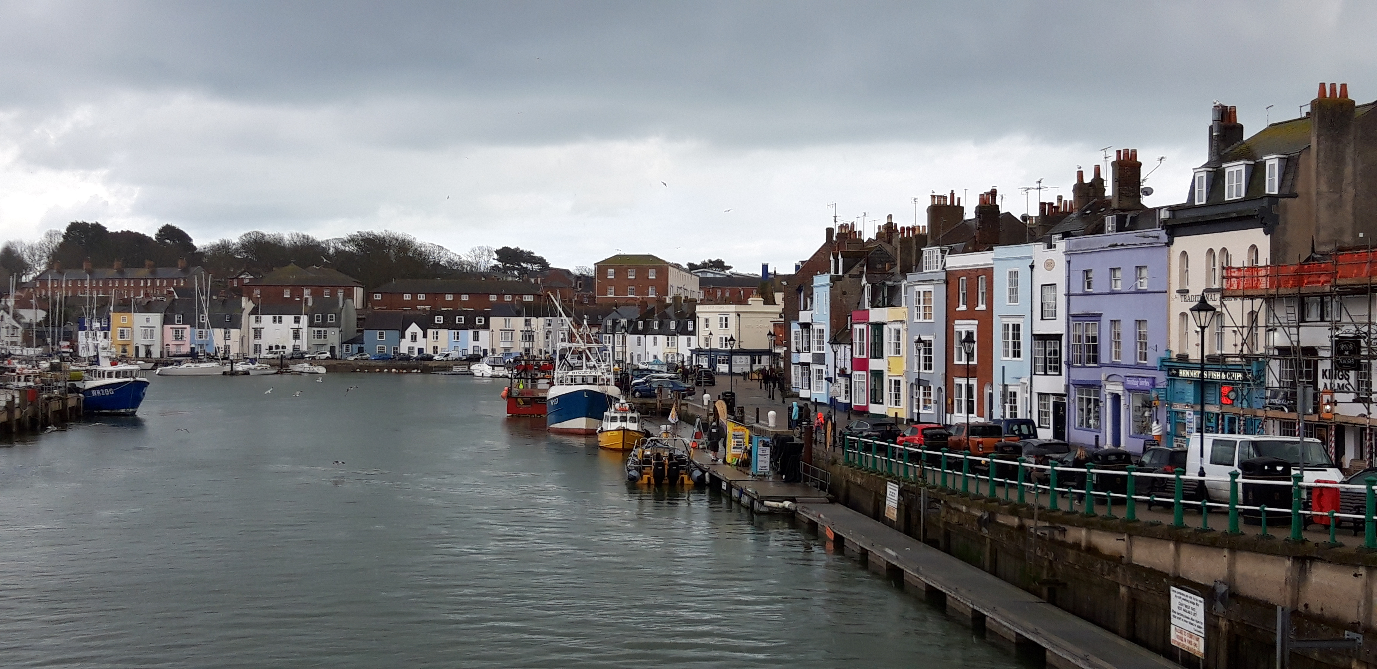
A blister has checked in on my right foot. Not bad – end of day three of this trip and the first blister has only just arrived.

The guide had promised me outstanding beauty, with unique views of Chesil Beach and the Fleet. But looking back on the day it was a bit – well – dull.

And did I mention the mud?

Next day is quite a contrast. At first, I had dismissed the fact that the coast path technically ran around the edge of the Isle of Portland. Why would I want to walk 13 miles just to be back at the same point? For a long time, I assumed that I would reach Weymouth and continue east.

But then I saw the appeal of staying two nights in Weymouth, leaving my stuff in my room, and having a day’s walk WITHOUT THE RUCKSACK. Added to the mix is the fact that Big Sister has come down from Wiltshire to do the Portland walk with me.

Also add to the mix that there’s no rain. The wind has died down. And there’s even some sunshine. And a lot of the Path around Portland is firm and level, with great views of Chesil Beach and the coast east of Weymouth.

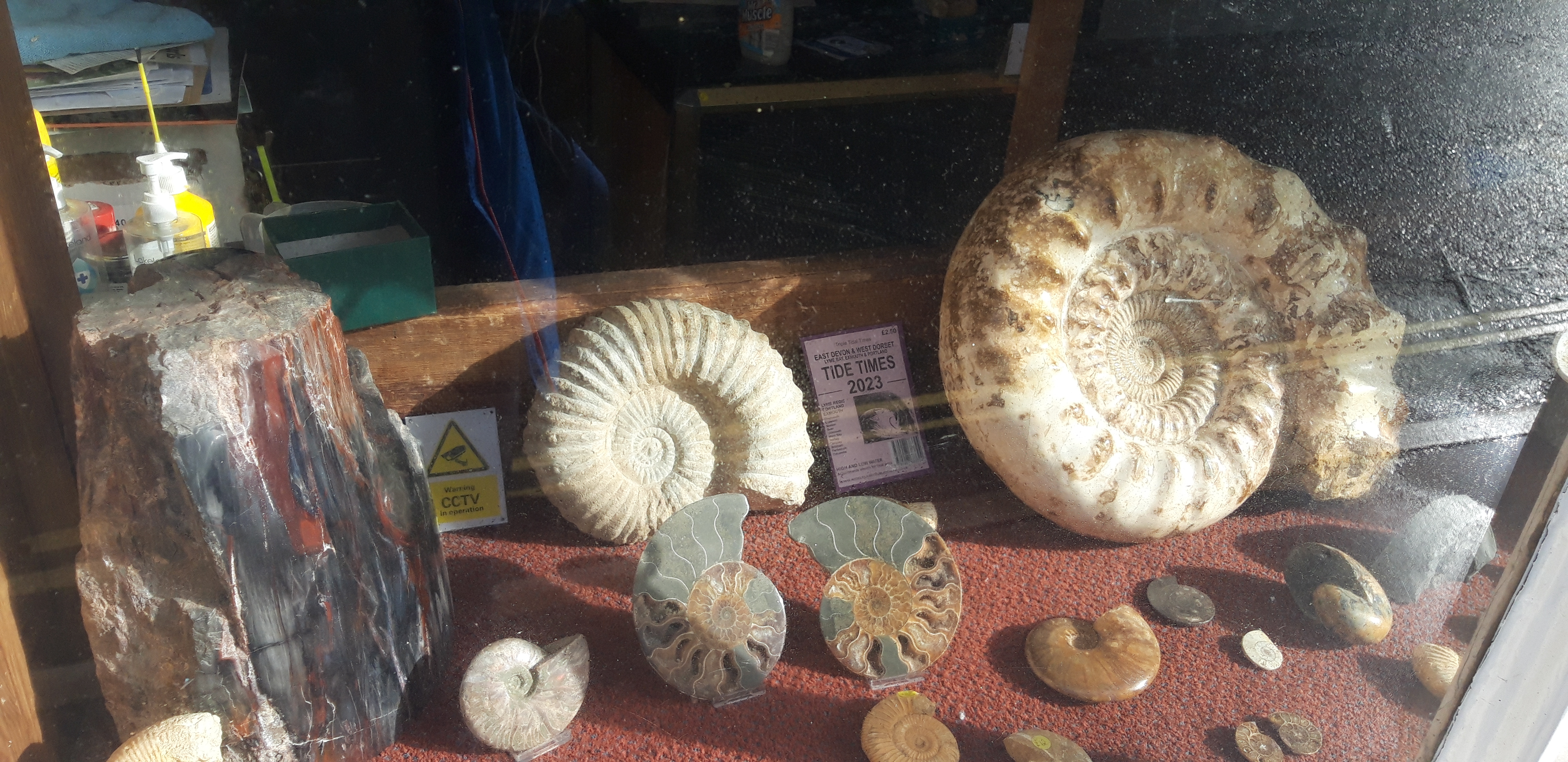
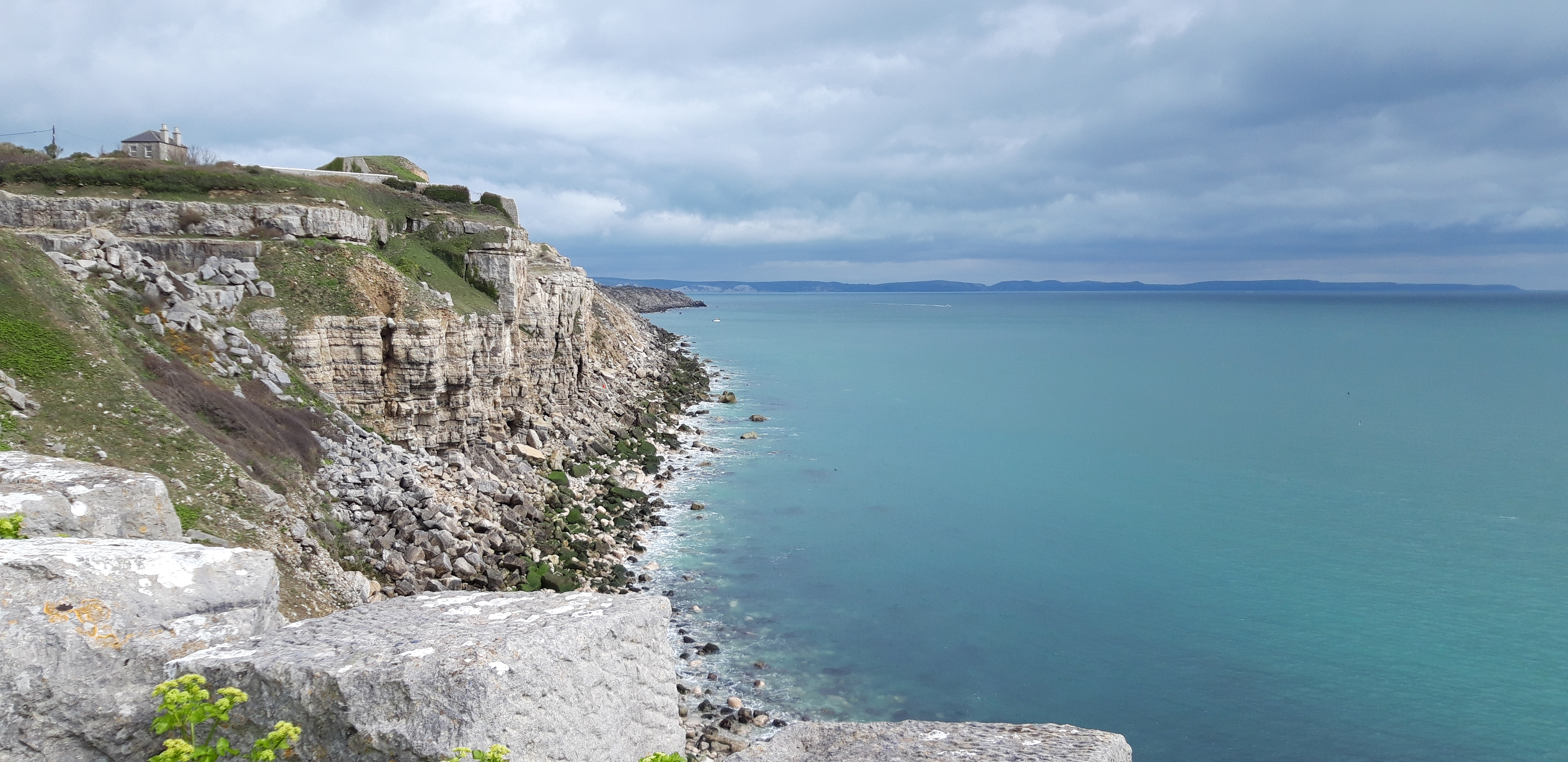
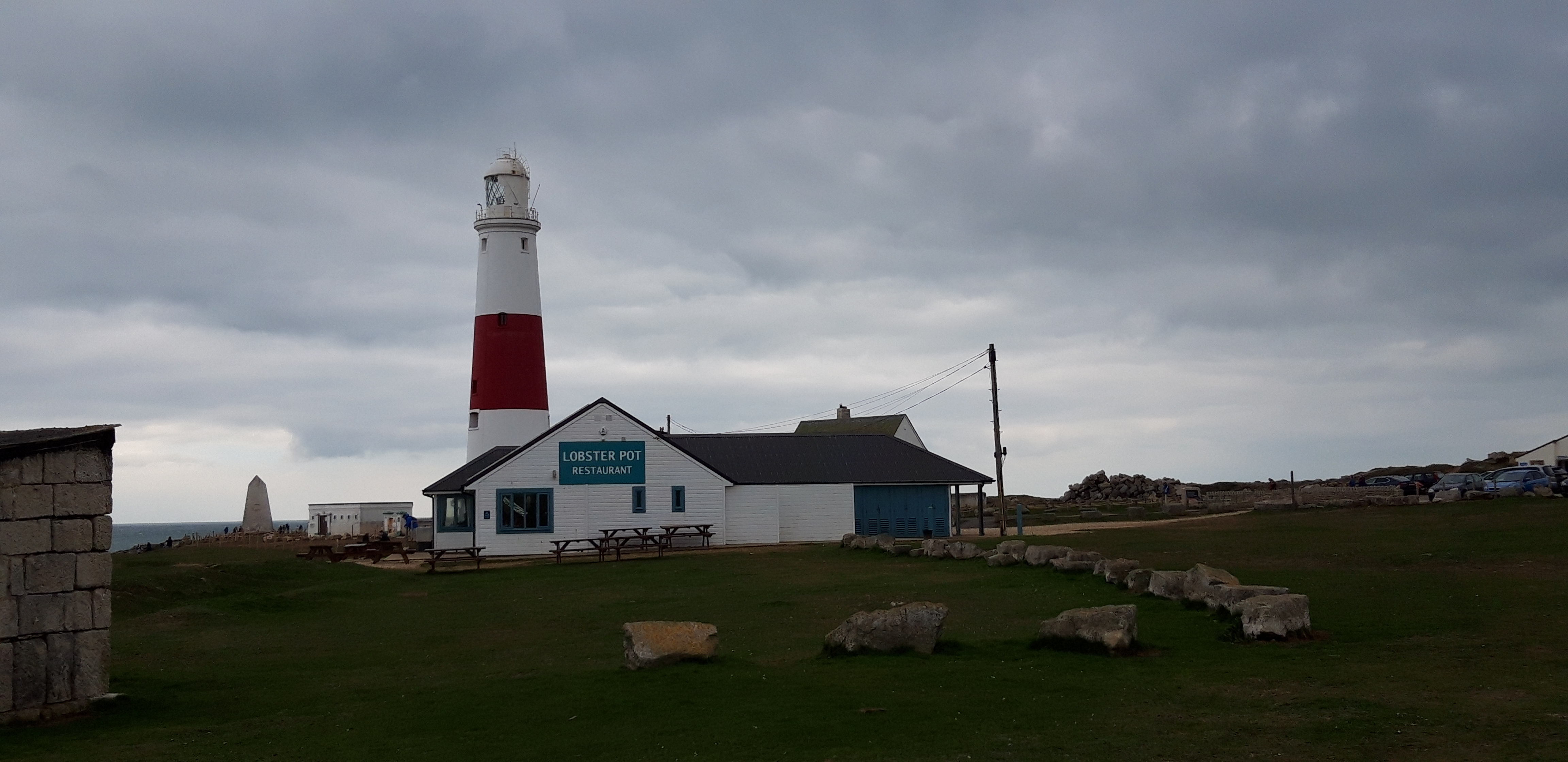
It turns out to be a lovely stroll around the island, with a break at the lighthouse for coffee and Dorset Apple Cake.

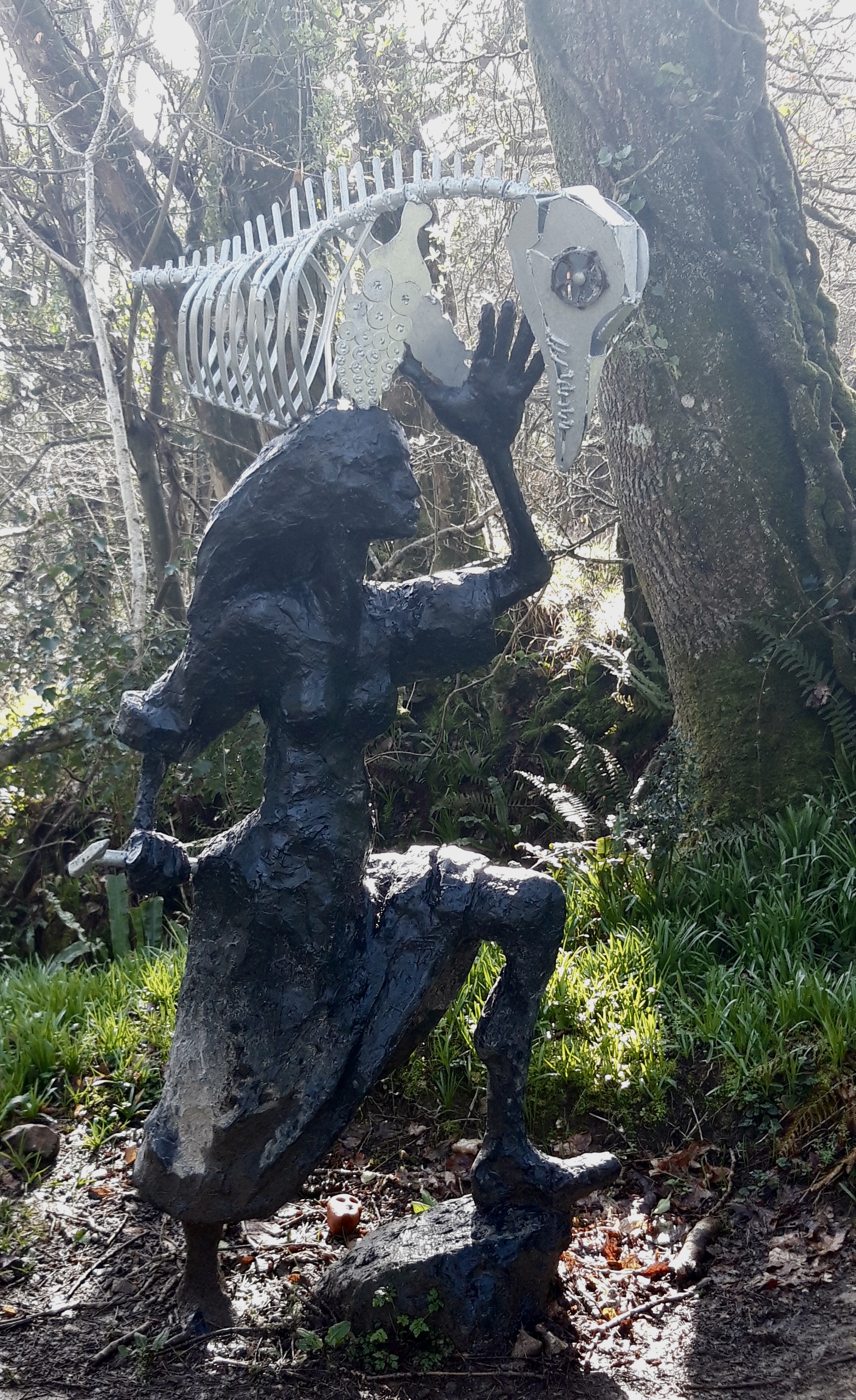
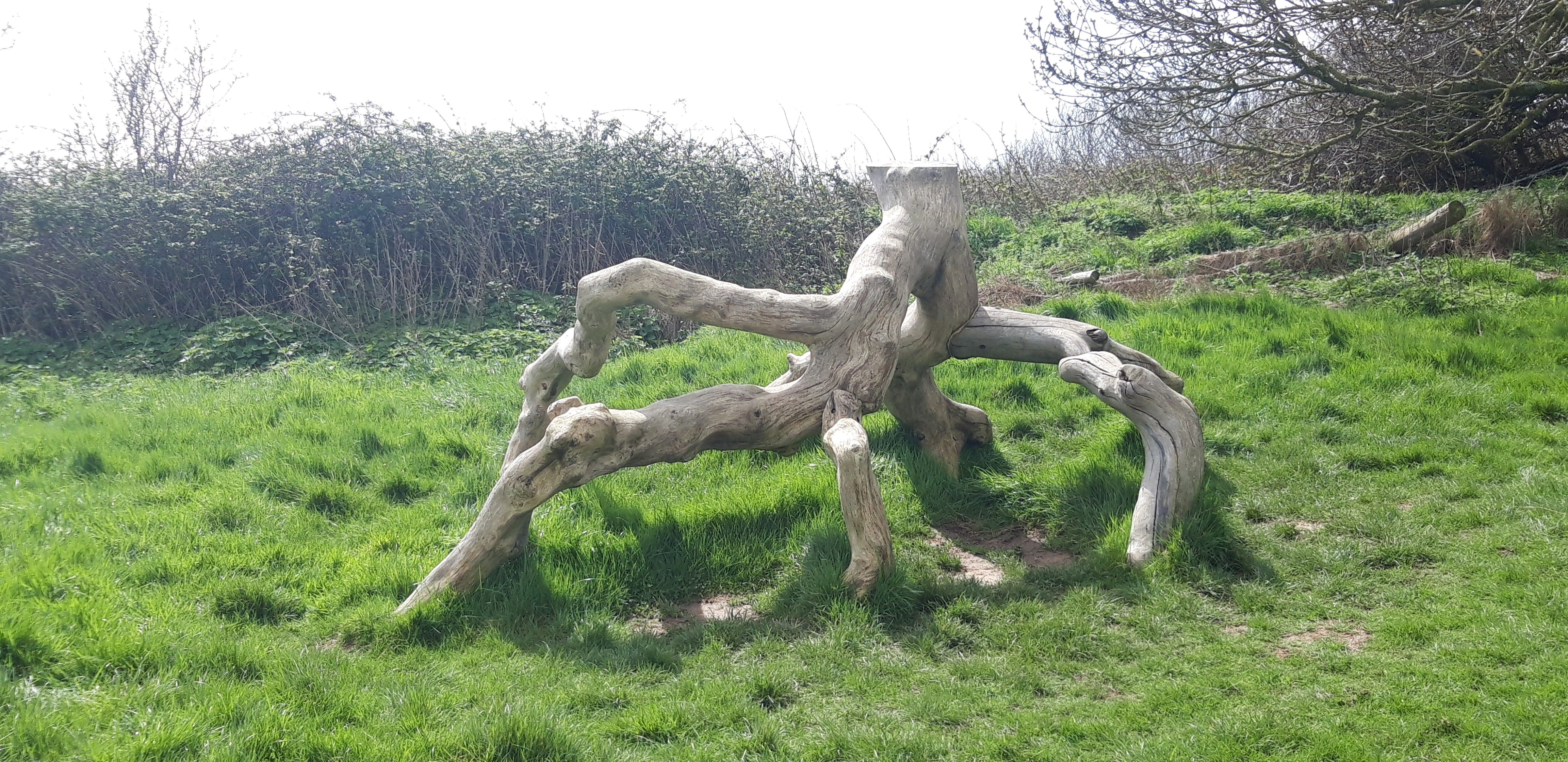
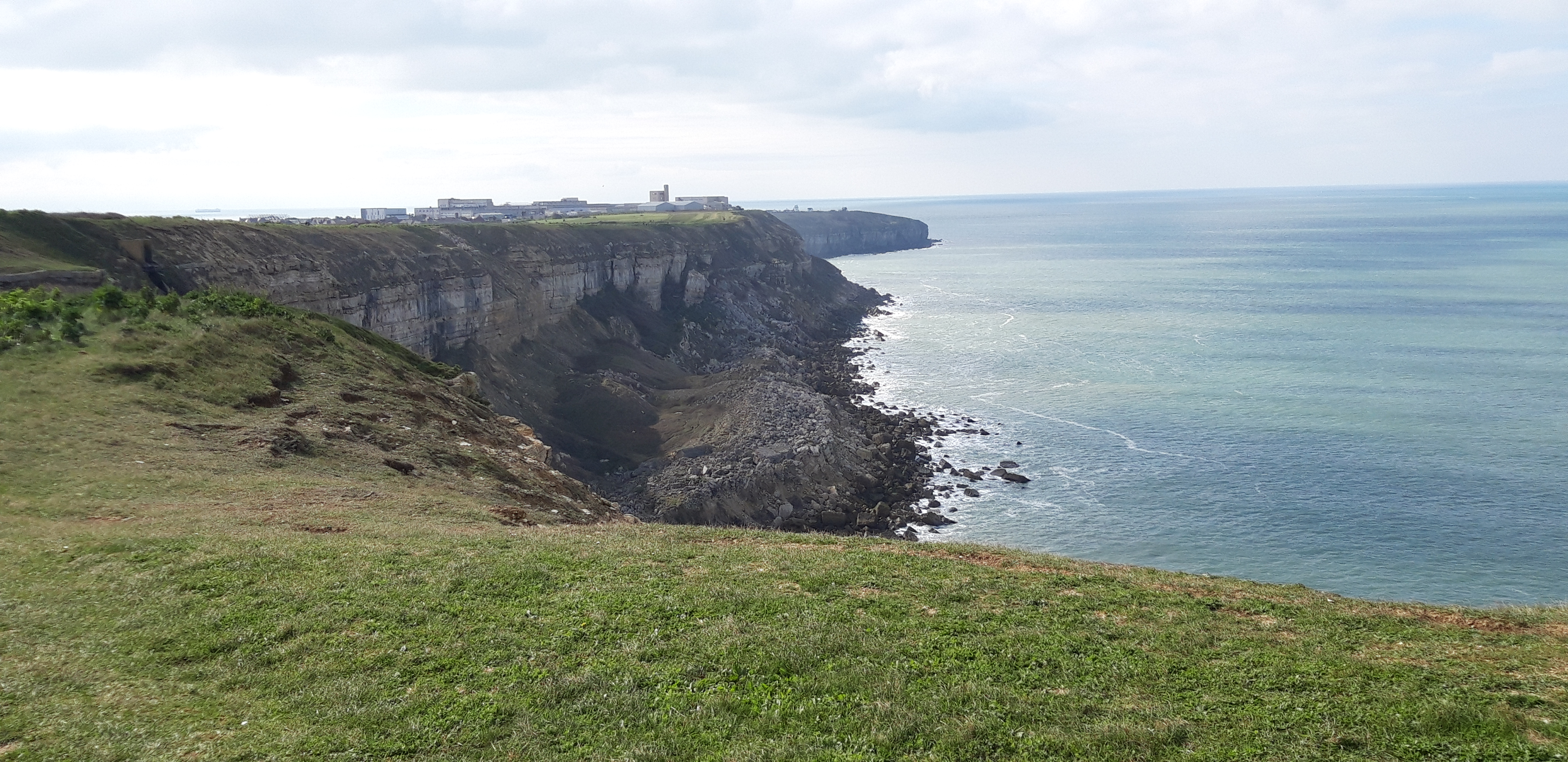
Portland has two prisons and a lot of quarries, one of which is now disused but repurposed as a sculpture park.

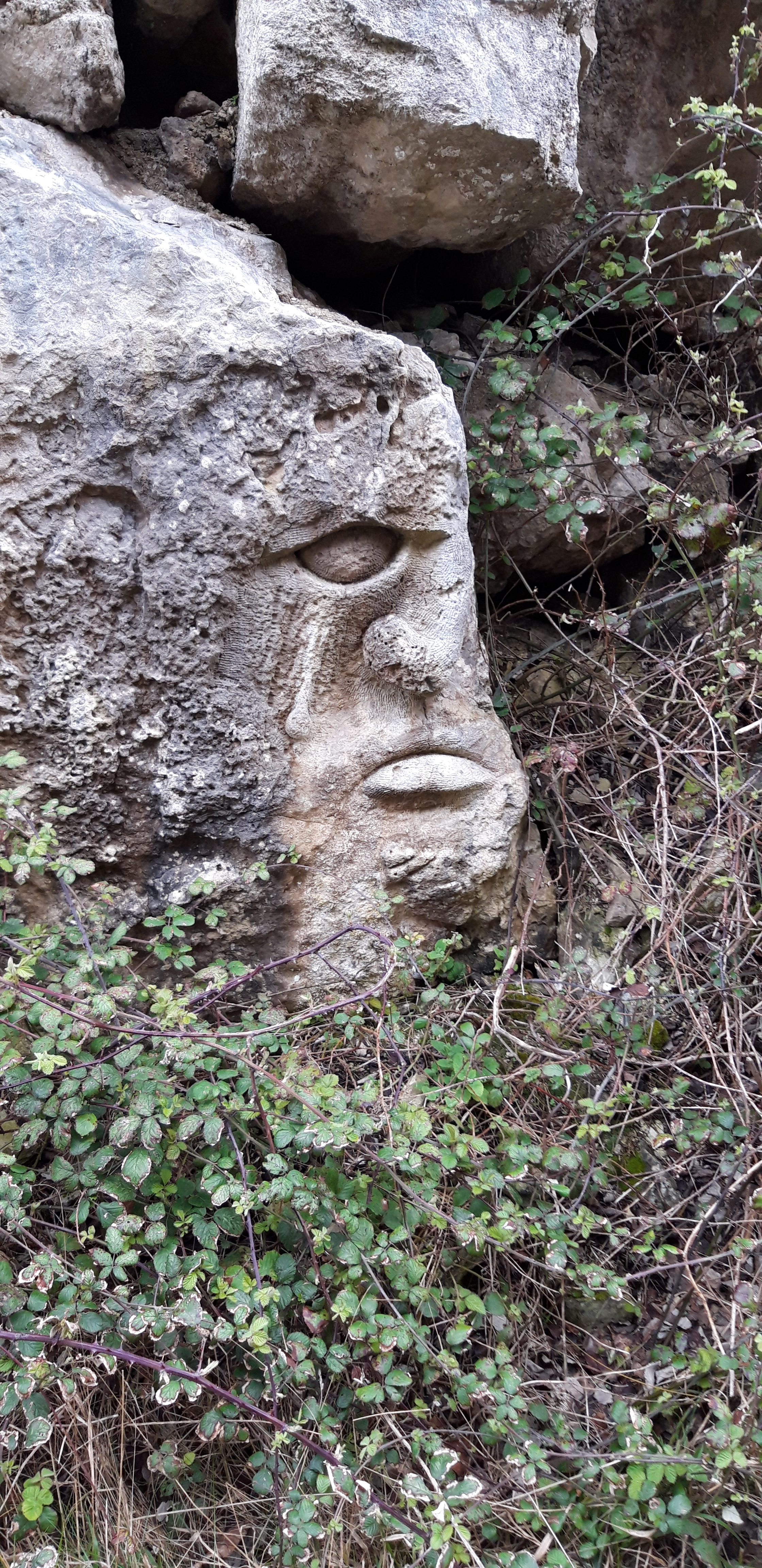
One particularly spooky character stays with me during the day.


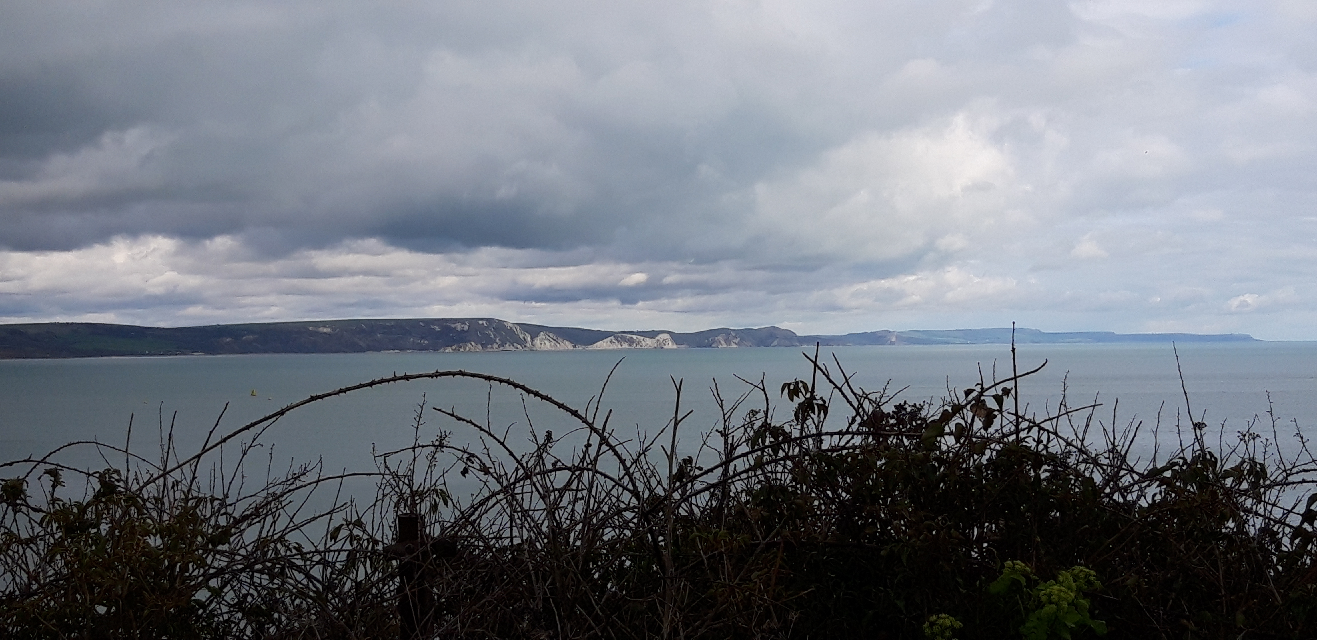
I end up back in Weymouth, with a view of the coast that lies ahead. I have walked 590 miles of the Path, with now a mere 40 miles to the end.

I don’t know how I feel about that.

1 Comment

Filed under South West Coast Path

Mud and Chesil Beach. And More Mud: South West Coast Path – Day 41

Eype’s Mouth to Abbotsbury

28,000 steps

In the morning I do a quick stocktake. Water is everywhere. Lying in pools on the ground, dripping from trees and buildings. Spraying itself liberally into my face as I set out, assisted in reaching all parts of me by the vigorous wind.

On the plus side – I’ve had coffee. And there are no blisters. Yet.

And after an initial downpour, the rain fades. The Path is however even muddier than yesterday after a further night’s rain. Mud will become a theme of the day.

I’m promised a walk along a “spectacularly dramatic section of the Jurassic Coast World Heritage Site”. Beginning, the guide says, “with some short, steep climbs”.

I’m also promised the chance of peregrines, possibly visible from Burton Cliff, and level going as I reach “the spectacular, long pebbly sweep of Chesil Beach.”

Leaving Eype’s Mouth, the Path is very slippery. And did I mention that the morning is very windy? I put up the hood of my cagoule as I climb the slope towards West Bay. The wind rattles it so fast and loud around my ears it sounds like a helicopter landing behind me. The wind is gusty and uneven, causing me to stumble a few times. I make a mental note to keep close to the line of the fence, not the cliff. Signs warn of unstable cliff edges, I don’t want to add an unstable walker to the mix.

At last, in the distance I can see the Isle of Portland, a faint smudge on the horizon through a haze of cloud and spray. I stop for coffee in West Bay. While I drink it, rain sweeps in from the churning sea on the high wind. Foam coats the harbour like fresh snow. I waste ten minutes trying to get the rain cover on my rucksack and my full poncho over me and pack. This takes so long that the rain stops and I give up.

I climb a steep slope up muddy steps from West Bay, and along the cliff top. The Path here joins something called the Hardy Way. So that cheers me up. The wind playfully assaults me all the way from West Bay to Burton Beach. Despite the wind, there’s less rain than forecast, which I have to admit is a big plus.

At Burton Bradstock, I pass from one Ordnance Survey Explorer map to another. I think this is the 14th map of the Path, and it will be the last, taking me all the way to Poole. There is no sign of any peregrines. They’re probably tucked up somewhere warm and dry, toasting crumpets.

The start of Chesil Beach

I’m also now on Chesil Beach. Chesil is a 17-mile ridge of pebbles, backed by the the largest tidal lagoon in Britain, the Fleet. It’s been the scene of numerous shipwrecks, and it was renamed Dead Man’s Cove by the ever-cheerful Thomas Hardy.

I read somewhere that over thousands of years the wind and sea have sorted the pebbles on Chesil Beach so that different sizes are distributed along the bank, with larger stones in the east, smaller in the west.


My research (not yet peer-reviewed) backs this up.

The Path veers slightly inland. For a while, it’s pleasant walking, shielded from the wind by the high shingle bank. But after a while the Path gets very boggy and I wonder whether it might not have been better to walk on the shingle itself.

The Path becomes a sea of mud and the next half hour is even less enjoyable than the spin-cycle experience of the cliff top walk.

It’s a relief when the Path veers right and back onto the gravelly bank.

I hate to grumble, but I confess that wading over the shingle is very energy-sapping. The novelty soon wears off. My calves begin to complain.


I’m relieved to find a cafe at West Bexington, where I have soup and coffee (and relief from the wind).

After lunch there is more shingle-wading, but eventually the Path gets easier and becomes a patchily tarmacked road behind the Chesil ridge. (With occasional stretches of mud.)

I’m alone most of the afternoon, which is unsurprising in this weather.

The sun breaks through in mid-afternoon, and the Path veers inland, as the Fleet separates Chesil Beach from the mainland, leading up and into Abbotsbury.

The village is truly the heart of Hardy country, but I forgive it for that. It has thatched cottages and a swannery, which claims to be the only place in the world where you can “walk through the heart of a colony of nesting mute swans.”

There’s also a 14th century chapel to St Catherine, the patron saint (it says here) of spinsters and virgins.

Abbotsbury is on the route of another long-distance trail – something called the MacMillan Way. This turns out to be a path all the way from Abbotsbury to Boston in Lincolnshire. With Poole only around 60 Miles away, I might soon need a new path…

Leave a comment

Filed under South West Coast Path

Tagine, Sourdough, and Dorset Gold: South West Coast Path – Day 40

Lyme Regis to Eype’s Mouth

26,000 steps


On the train I eat a sandwich and take stock of the way the world is, six months on from my last encounter with the coast path. Scientists have warned that the world is on its last chance to tackle global warming. The world has shrugged. We have carelessly got through several prime ministers and sundry other ministers as the government has been forced to shovel money into people’s pockets to pay inflated energy bills. The council I’m part of has had to scrape together money for schools to feed children turning up to school hungry.

And in the newspaper I read that astronomers have found an “ultra massive black hole around 33 billion times the mass of the sun.” 

Outside the window there is no sign of the sun, owing to a sky emulsioned with mist. Nor, thankfully, is there any sign of an ultra massive black hole. Clouds dip low and touch the treetops, breathing soft rain over the fields. There seems to be an awful lot of mud.

Lyme Regis with subtle ammonite-themed lampposts

The Path however abides. It’s waiting for me when I step off the bus at Lyme Regis. The guide promises that today’s walk is ‘moderate’. It includes a climb over Golden Cap, the highest point on the South coast of England, so there’s that to look forward to. The weather forecast promises sunny intervals today. It seems good to get the high ground out of the way early – tomorrow’s weather forecast is an absolute dog.

The tide is coming in, ruling out the beach walk to Charmouth, so I head along a newly-engineered raised path below the eroding cliffs and up some steps to the road, before the Path turns off into a very muddy field and angles uphill towards some woods.

Leaving St Ives

The sound of the road falls away behind, and I’m soon immersed in birdsong and the rattle of the wind among wintry branches of shrubs and trees. The Path winds back and forth up and over the wooded hillside, with a few too many counter-intuitive turns away from my assumed direction of travel because of landfalls.

The Path soon zigzags down toward Charmouth. A statue commemorates the fossil-plundering that has gone on in these parts over the years.

I’m now about halfway along the “Jurassic Coast,” England’s only natural world heritage site, which stretches 96 miles from Exmouth to the end of the Path near Poole. Coastal erosion here has exposed nearly 200 million years of geological history.

At different times, the area has been desert, shallow tropical sea and marsh. In some areas (notably the one I’m currently in) landslides are common, which have exposed a wide range of fossils. Scores of different rock strata have been identified at Lyme Regis, each with its own species of ammonite.

At Charmouth Beach I stop for coffee and bread pudding, consumed above the pebbled beach, churning with slate grey waves. In the 18th and 19th centuries Charmouth village was a noted resort. Visitors included Jane Austen, who wrote that it was “a nice place for sitting in unwearied contemplation.”

Unlike Jane, I’m not sitting. I’m not contemplating. And to be honest, I’m not unwearied.

The hill out of Charmouth
The “View” from Golden Cap

From Charmouth, the Path joins the so-called “Monarch’s Way,” commemorating the route taken by Charles II after defeat at the Battle of Worcester in 1651, before slipping away to the Continent and leaving England to Cromwell. An inn here supposedly gave shelter to the fugitive Royal, when he came disguised looking for a boat to take him to France. He got away, but not before a mishap with the first boat that was lined up for him. The boat’s master was prevented from helping Charles when he let slip the plan to his wife and she locked him in his room and stole his clothes to keep him from getting involved.

Leaving Charmouth, I climb up a long and muddy hillside. A misty rain drives in off the sea to spice up the climb. After a while the rain fades and clouds clear. After a few minutes of the sun’s heat the soggy ground exhales a moist warmth up at me.

At the top, the Golden Cap summit is shrouded in cloud. The view along the coast from here must be amazing. On a clear day. Which this is not.

Once you’ve passed the south coast’s highest point it must be downhill all the way to Poole. The first part of the descent, into Seatown, is again very muddy and slippery. Making me grateful – not for the first time – for my stick, which repeatedly prevents me applying my face or backside to the mud.

Over lunch in Seatown’s Anchor Inn, I reflect on social change since the 80s. I eat winter vegetable tagine, with sourdough bread and a pint of Dorset Gold bitter. The music is an unbroken cool playlist of 70s reggae. Forty years ago, when I first walked the Ridgeway, you were grateful for keg beer and salted peanuts and an expensive jukebox stuffed with Leo Sayer and David Essex.

Seatown Beach, with Anchor Inn

Further back in time, Seatown used to have a Whit Monday Fair. In Thomas Hardy’s novel, The Mayor of Casterbridge, the young Michael Henchard, gets drunk on rum-laced Furmity (a mix of wheat, dried fruit and sugar, often with added spirits). So potent is this brew that he auctions off his wife Susan, along with their baby daughter, to a passing sailor. Like most Thomas Hardy characters, in most Hardy novels, it’s fair to say Henchard lives to regret his actions.

After lunch, it looks like a straightforward stroll over Thorncombe Beacon to Eype’s Mouth. But over lunch the wind has grown massively in strength, sweeping curtains of cloud and rain in from the sea. For a while I’m completely enclosed in a glowing globe of cloud, unable to see the ground at the foot of the hill in any direction, guided only by the fact that the mist over the sea is brighter than that over the land. 

I’m walking through a Lovecraftian landscape of mist and skeletal trees.

And misshapen tree stumps, like the claws of dead monsters.

All of which makes me glad to descend again out of the mist, this time into Eype’s Mouth.

I check tomorrow’s weather forecast again. Strong winds and rain.

1 Comment

Filed under South West Coast Path

Beer in Beer: South West Coast Path Day 38

Otterton to Beer

27,000 steps

Nature seems to have thrown enough at us for now and the next morning we wake up to sunshine and a blue sky dappled with tissue-thin clouds. We are serenaded by birdsong as we set out.

Rather than retrace our steps back down the River Otter, we head east, following minor roads towards the coast. We reach the Path after walking through a holiday park at Ladram Bay.

Ladram Bay
Continue reading

Leave a comment

Filed under South West Coast Path

Back on the Wily, Windy Moors: South West Coast Path – Day 34

28,000 steps

One estuary crossing (ferry)

The View from the Salcombe Ferry

I started walking the South West Coast Path in April 2016. It’s been quite a few years. We’ve had three prime ministers; the UK (eventually) left the European Union after a drawn-out political process that resembled a national nervous breakdown; Donald Trump became President of the US (and still seems to think he is); for two years; the world has been turned upside down by a global pandemic (which has killed 160,000 people in the UK alone, still lingers, and has changed our lives forever). My mum died. And now we have a brutal war in Europe that is like throwback to the 1940s.

I however am nowhere near completing this bloody Path. I know it’s the longest trail in England. I knew it would take a while. But really.

Continue reading

3 Comments

Filed under South West Coast Path

South West Coast Path Day 4

Ilfracombe to Braunton – 42,000 steps

Breakfast is an egg and tomato roll, instant coffee and a custard tart. I eat it on a wooden bench beneath Ilfracombe’s singular war memorial.

2016-04-14 08.17.10

War Memorial, Ilfracombe

The sun is already painting the roofs of buildings a sumptuous amber colour, and burning off the early haze. Seagulls cackle loudly all around, children are walking to school.

It’s a peaceful scene and I’m reluctant to start my day’s hike. I have a long day ahead of me. Not as long a walk as Day 2, but one thing that I didn’t factor in when I planned the trip was that the legs get tired and each day’s miles feel longer. Plus, it turns out that Devon coastal miles are longer than London and south east England (flat) miles.

Continue reading

1 Comment

Filed under Places, South West Coast Path